
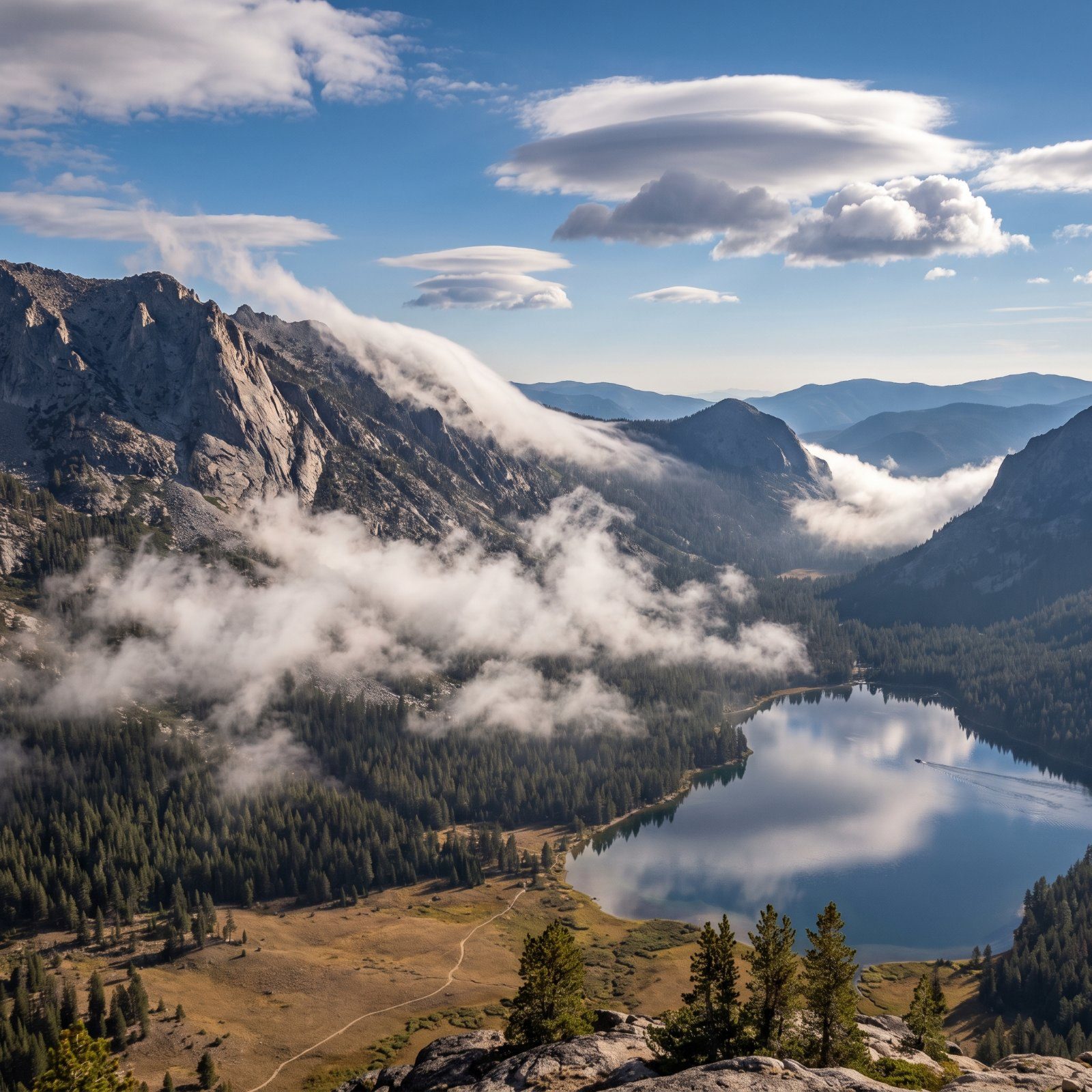
The best forecaster on a ridge at dawn is not the app clawing at one bar of signal. It’s the banner of cloud streaming off the summit, the sound of a truck on a road three valleys over coming through too clearly, the frost stacking on one side of a fence post and not the other. The sky files its report early — in cloud shapes, wind streaks, the way distance behaves. Learn a handful of these and you’ll know a storm is building while everyone else is still waiting for the little animated radar to load. Here’s what to watch for.
Please note that some of the images in this article were created with the assistance of AI.
41. Rain That Evaporates Before It Lands Can Fire Off Dangerous Downbursts
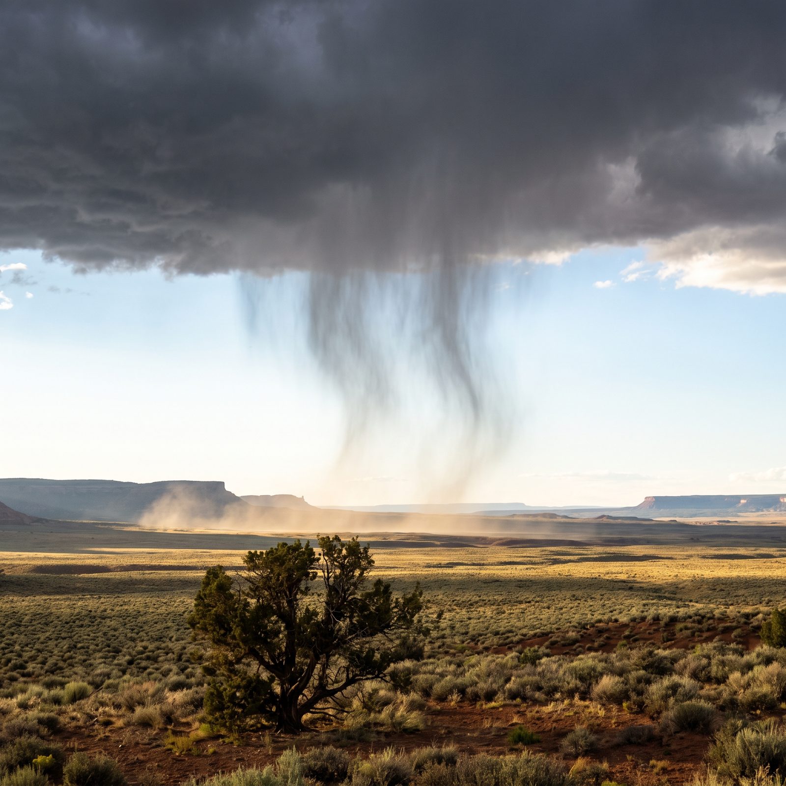
You see it and think, nice, the rain’s missing us. Wrong thing to feel relieved about. Those feathery gray streaks hanging under a cloud and fading before they hit the dirt are called virga, and they mean the rain is evaporating in dry air on the way down.
Evaporation cools that air hard, and cooled air is heavy air that falls. Sometimes it comes down all at once as a downburst — a slug of wind that hits the ground at highway speeds and blows out sideways. Boaters have been caught flat by it on an otherwise glassy lake. See virga, feel the breeze go dead still, and start paying attention to your tent stakes and your anchor line.
40. A Falling Barometer, or a Watch That Thinks You’re Climbing, Means Air Pressure Is Dropping

A trick most hikers never use. An altimeter watch doesn’t measure height directly — it measures air pressure and converts it. So if you’ve sat at the same camp for two days and your altimeter slowly claims you’re gaining elevation, you aren’t levitating. The pressure is dropping, and the watch is reading the drop as altitude.
Falling pressure is weather coming. A slow decline usually means a front a day out; a fast drop means it’s close and it means business. A barometer does the same job more honestly if you’d rather carry one.
Calibrate the watch to a known elevation when you arrive, then just watch it drift.
39. A Shrinking Ring Around the Moon Means the Cloud Droplets Are Growing
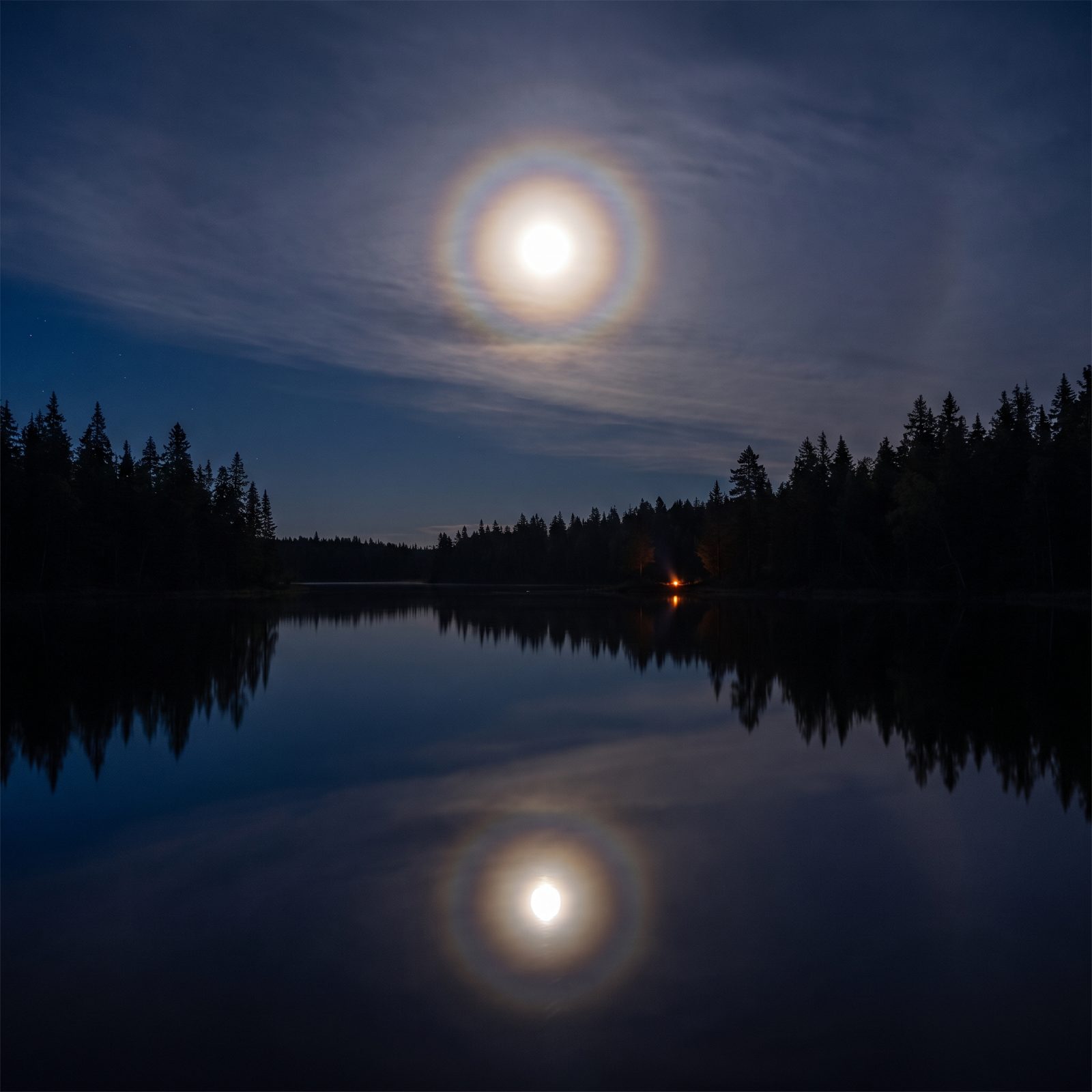
A corona is that tight colored ring hugging the moon when thin cloud slides across it. Different animal from a halo. The ring comes from light bending around water droplets in the cloud, and its size tells you something about those droplets.
Small droplets make a big ring. As the droplets grow, the ring shrinks in toward the moon. Watch a corona over an evening and if it tightens down, the droplets inside the cloud are fattening — and fatter droplets are closer to falling as rain. Slow signal, not an alarm. But it’s one of the few ways to read what’s happening inside a cloud with your own two eyes.
38. Breaking-Wave Clouds Betray Violent Wind Shear Overhead
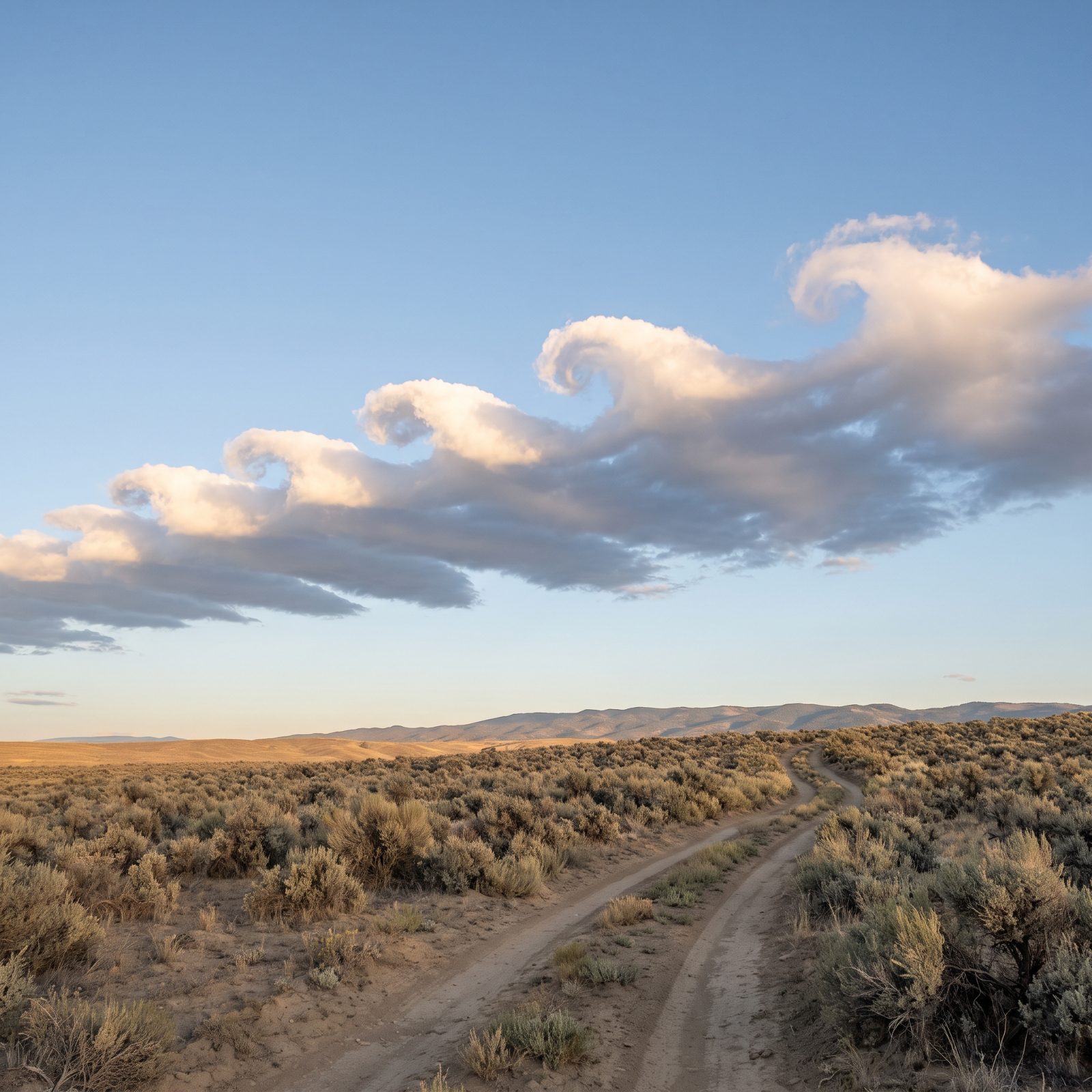
Catch a row of clouds shaped like curling ocean waves frozen in the sky and you should stop and look, because most people never see it once. Those are Kelvin-Helmholtz waves. They form where a fast layer of air slides over a slower one and rolls the boundary between them into breakers.
They don’t last. A few minutes, usually, before they smear out. While they’re there, though, they’re telling you there’s strong wind shear aloft — a sharp change in wind speed with height. Pilots care about that. So should you if you’re on a ridge or headed up high, because shear up there often runs ahead of gusty, unsettled conditions down where you are.
37. Distant Sounds Carrying Too Far Reveal a Temperature Inversion
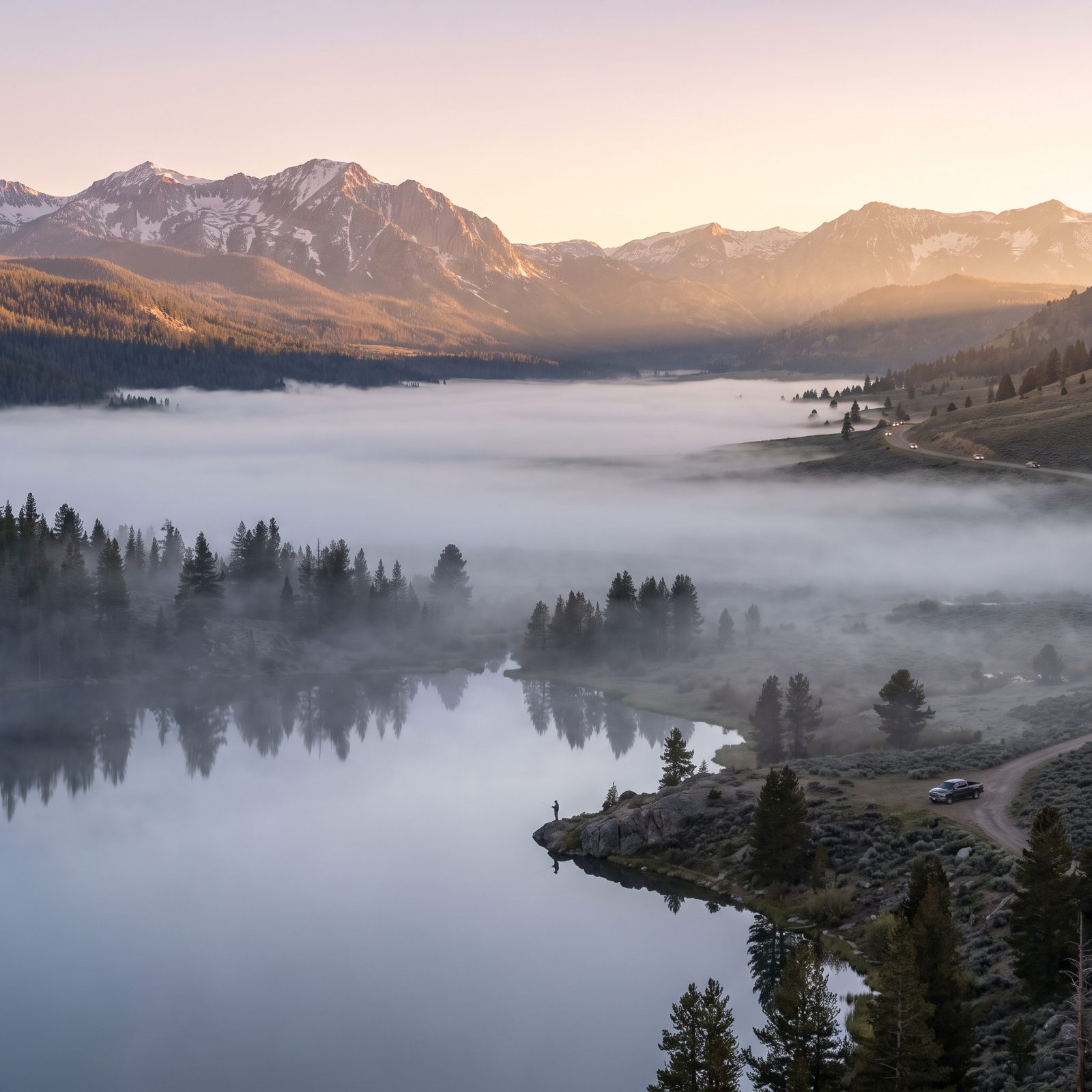
Some mornings you hear a dog bark, or a train, or voices from clear across the valley, sharp as if the whole world drew closer overnight. Not your imagination. It’s a temperature inversion — a layer of warm air sitting on top of cold air near the ground.
Normally sound bends upward and dissipates. Under an inversion it bends back down toward the surface and carries for miles. A strong overnight inversion usually means still, stable air, and often fog settling into the low spots. Good news for a calm paddle at first light. Less good if you’re waiting on a morning breeze to fill a sail.
36. Frost Building on One Side of Everything Shows Supercooled Fog and Wind
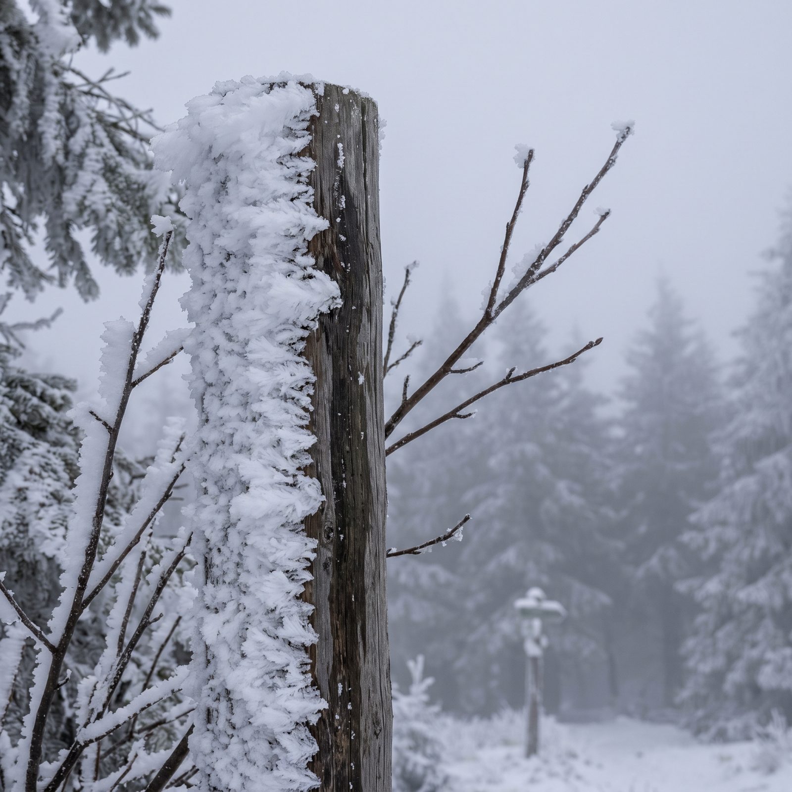
Walk through a frozen fog and you’ll notice the ice isn’t even. It piles up thick on one side of the fence posts, the trees, even the guy lines on your tent, and leaves the other side nearly bare. That one-sided buildup is rime, and it forms when supercooled fog droplets freeze the instant they hit something.
The loaded side is the windward side. So rime is a compass for the wind that laid it down, often overnight while nobody was watching. Read the posts and you know which way the weather’s been shoving. It also tells you the air ran cold enough and wet enough to deliver icing — which matters a great deal on exposed terrain.
35. A Banner Streaming Off a Summit Marks Fierce Ridge-Top Wind

You’ve seen the photos of Everest or the Matterhorn wearing a long plume off one shoulder. That’s a banner cloud, and it isn’t smoke or blowing snow. It’s moisture condensing on the sheltered lee side of the peak, where wind racing over the summit drops the pressure enough to wring water out of the air.
The plume always streams downwind, and longer, more ragged means stronger wind up top. Eyeing a high route or an exposed camp? A hard-streaming banner is a plain warning that the ridge is getting hammered, even while it sits dead calm in your sheltered valley. Trust the summit’s forecast, not your own.
34. Torn, Churning Rotor Clouds Mark Brutal Turbulence Below Mountain Waves

The smooth lens-shaped clouds up high are the pretty part. The rotor clouds beneath them are the warning.
When strong wind crosses a mountain range it sets up standing waves in the air downwind. High up, those waves carve the tidy lenticular clouds everybody loves to photograph. Down near ridge level, the same waves can spin up a churning, ragged roll of cloud called a rotor, and inside it the air is violently turbulent.
Glider pilots treat rotors as genuinely dangerous. On the ground it means savage, shifting gusts raking the lee slopes and valleys. Spot smooth lenticulars stacked over a range with torn, tumbling cloud beneath them, and the lee side is no place to pitch a tent or trust a calm-looking lake.
33. A Mountain Cap That Keeps Thickening Means Moist Air Is Being Shoved Upward
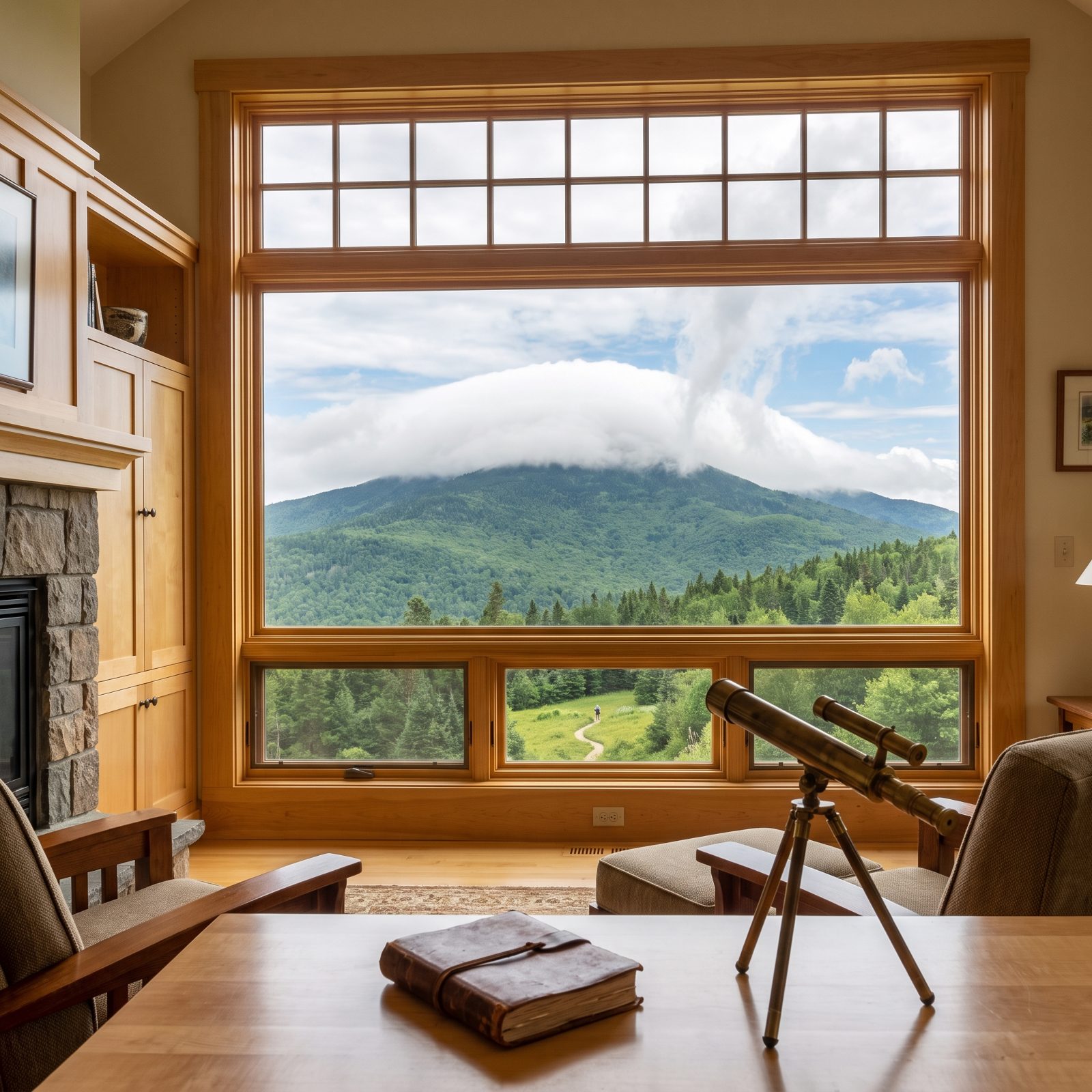
A single cloud parked right on a peak like a cap is orographic — the mountain itself is making it. Air gets forced up the slope, cools as it rises, and the moisture condenses out over the summit. A thin, steady cap is just the mountain doing its thing.
Watch what it does over an hour. If that cap keeps thickening and climbing taller, the air flowing in is getting wetter and the lift is strengthening. Often that’s the opening move of a weather change rolling in on the upslope flow — the mountain’s way of telling you more moisture is coming.
32. Fog Pouring Over a Saddle Shows Air Spilling Across the Divide
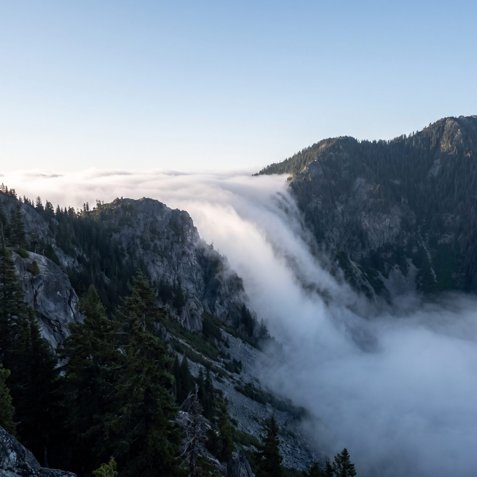
Watch a low saddle between two peaks long enough and you may see fog spill through it like water over a dam, pouring down the far side and dissolving as it drops into the warmer, drier air below. It’s one of the clearest demonstrations you’ll ever get of air actually moving across a divide.
The fog is marking the airflow. Which direction it pours tells you which way the lower atmosphere is pushing, and a thick, steady cascade usually means the moist, cooler air is winning and advancing. If it’s flowing toward your side of the range, expect that damp air to reach you — often with a drop in visibility and a shift in the valley wind.
31. A Smoke Column Bending Sharply at One Height Exposes a Wind Shift Aloft

Watch a campfire burn long enough and the smoke tells you about two winds at once. Near the ground it drifts with the breeze you feel on your face, but higher up it can swing and race off in a completely different direction.
That kink marks where surface air gives way to the wind aloft. A sharp bend means the layers are shearing against each other, and shear is often the first hint that a front or an approaching low is rearranging the air above you.
30. Dark Cat’s-Paw Ripples Show Where Fresh Gusts Are Touching a Lake

On a calm lake at first light the water works like a pressure gauge. Where the surface stays mirror-flat, the air is still. Where a dark, matte patch spreads and crawls toward you, a gust has landed.
Anglers call these cat’s-paws and read them without thinking. A few drifting patches mean a light, variable breeze. But when those patches start linking up and marching steadily from one quarter of the sky, the wind is filling in, and it’ll hold.
29. Long-Period Swell Can Reach a Coast Before a Distant Storm

A perfectly clear sky over a calm beach isn’t always the all-clear it looks like. Big, smooth, widely spaced swells rolling in under blue sky often carry a message from a storm hundreds of miles out at sea.
That kind of swell travels fast and far, outrunning the weather that made it. The waves feel slow and powerful, with a long count between crests, and they can build dangerous rip currents and shore break days before the first cloud ever shows.
28. Intersecting Wave Trains Reveal Winds or Swells Arriving From Different Directions

Water coming from two directions at once makes a pattern you can’t miss once you know it. Instead of clean parallel lines, the surface breaks into a crosshatched diamond grid, steep little pyramid peaks stacking up where the two trains meet.
That confused sea means two things are going on: an old swell from a distant system is colliding with a fresh local wind, or the wind itself has recently shifted. For anyone in a small boat, those crossing seas are the warning. Conditions are changing, and the ride home may not match the ride out.
27. Short Wind Chop Running Against the Swell Signals a Local Wind Change

Swell is slow and smooth. Wind chop is small, steep and busy. When you see tight chop crowding over the top of a long swell and running the opposite way, the local wind has just swung.
The swell still carries the memory of the old wind, or a far-off storm. The chop is the new wind writing over it in real time. That mismatch tends to show up right as a sea breeze kicks in or a frontal shift arrives, and it usually means rougher, lumpier water on the way.
26. Whitecaps Spreading Across Open Water Show Wind Has Crossed a Useful Threshold

Whitecaps aren’t random. They start showing up once the wind reaches roughly twelve to fifteen knots, and that number is about as reliable a rule of thumb as you’ll find on the water.
A few scattered breaks mean the wind is picking up but still manageable. When whitecaps spread across the whole surface and keep multiplying, though, the wind has settled in above that threshold and isn’t backing off anytime soon. For a small open boat or a kayak, that’s the moment to think hard about getting back, not after the spray starts flying.
25. Raptors Losing Their Soaring Height Show Daytime Thermals Are Weakening

Hawks, vultures and eagles flap only as much as they have to. They ride columns of warm rising air called thermals, which lets them hang and circle for hours while barely moving a muscle.
When the sun heats the ground, thermals run strong and the birds climb high. Watch them sink lower and start working harder through the afternoon and you’re seeing that lift fade. Often it just means evening is coming. But an early loss of lift on a cloudy afternoon frequently points to an approaching front cooling and stabilizing the air.
24. Altocumulus Castellanus Towers Reveal Instability Building Aloft
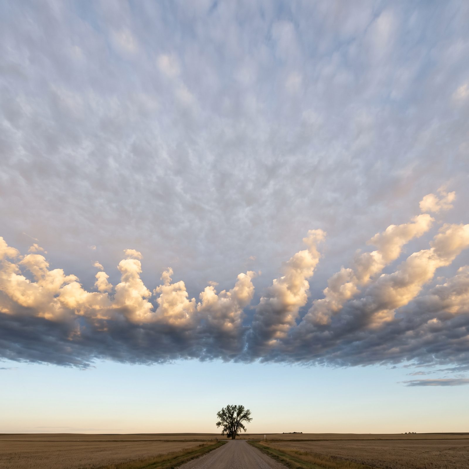
A morning sky dotted with little cloud turrets that look like a row of castle battlements is worth a second look. These are altocumulus castellanus, and the tiny towers sprouting from the cloud layer mean the air a few thousand feet up is already unstable.
Early instability like that is a loaded gun. If the day heats up as expected, those mid-level bubbles can seed afternoon thunderstorms. Experienced hikers and sailors treat castellanus before noon as a reason to plan an early finish, long before the first real storm cloud ever crawls over the horizon.
23. A Pileus Cap Above a Cumulus Tower Shows Explosive Upward Growth
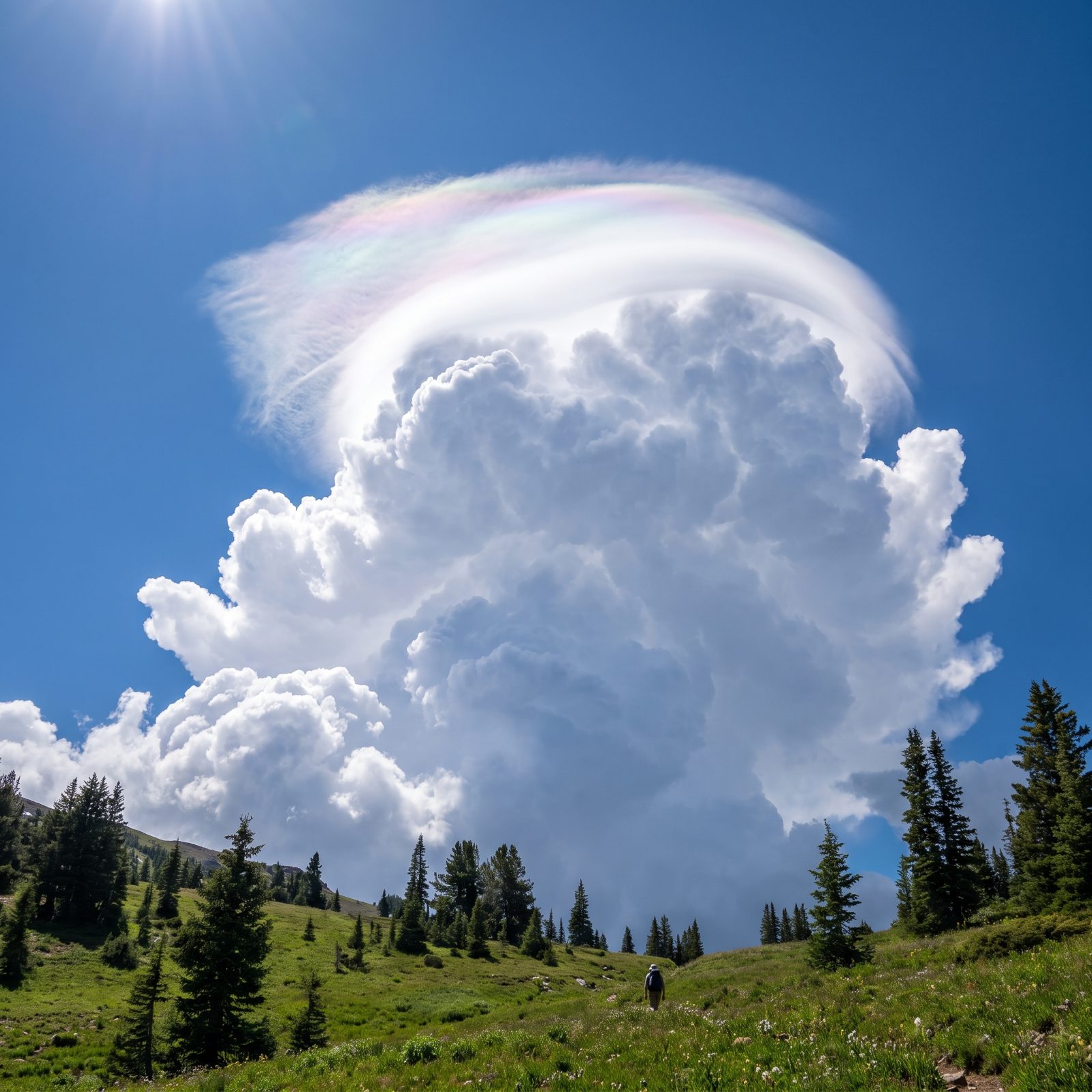
Every so often a growing cumulus tower wears a smooth, silky hood draped over its crown. That veil is a pileus cloud, and it forms when the tower punches upward so fast it shoves a moist layer above it into sudden condensation.
A pileus is a speed reading. It means the updraft underneath is strong and the cloud is shooting up hard enough to lift the sky ahead of it. Towers capped this way often grow into thunderstorms within the hour, so take it as your cue to get off exposed ridges and open water while there’s still time.
22. Cumulus Towers Flattening at One Level Reveal a Capping Inversion

When every cumulus in the sky flattens off at the same height, as though a ceiling got dropped over the whole afternoon, you’re looking at a capping inversion. A warm layer aloft is sitting on the rising air and refusing to let the clouds grow any taller.
For now that lid keeps the weather fair and the clouds tidy. A cap is temporary, though. If the air underneath keeps heating and one tower finally breaks through that ceiling, it can erupt into a severe storm with startling speed. A flat-topped quiet sky is sometimes the calm right before it.
21. Persistent Contrails Spreading Into Haze Signal Moist Upper Air

Watch what the jet leaves behind. A contrail that pops out white and vanishes in a breath means the air up high is bone dry, but a contrail that hangs there, then fattens and smears sideways into a milky sheet, is telling you the upper atmosphere is loaded with moisture.
And that moisture is the raw material for cloud. When contrails start lingering and spreading over the course of a morning, high cloud is usually sliding in ahead of a front. Blue sky now, thickening veil by afternoon. It’s one of the earliest hints you’ll ever get that a system is coming, showing up hours before the ground feels a thing.
20. Fog That Thickens Into a Stratus Deck Won’t Clear Like Fog That Thins
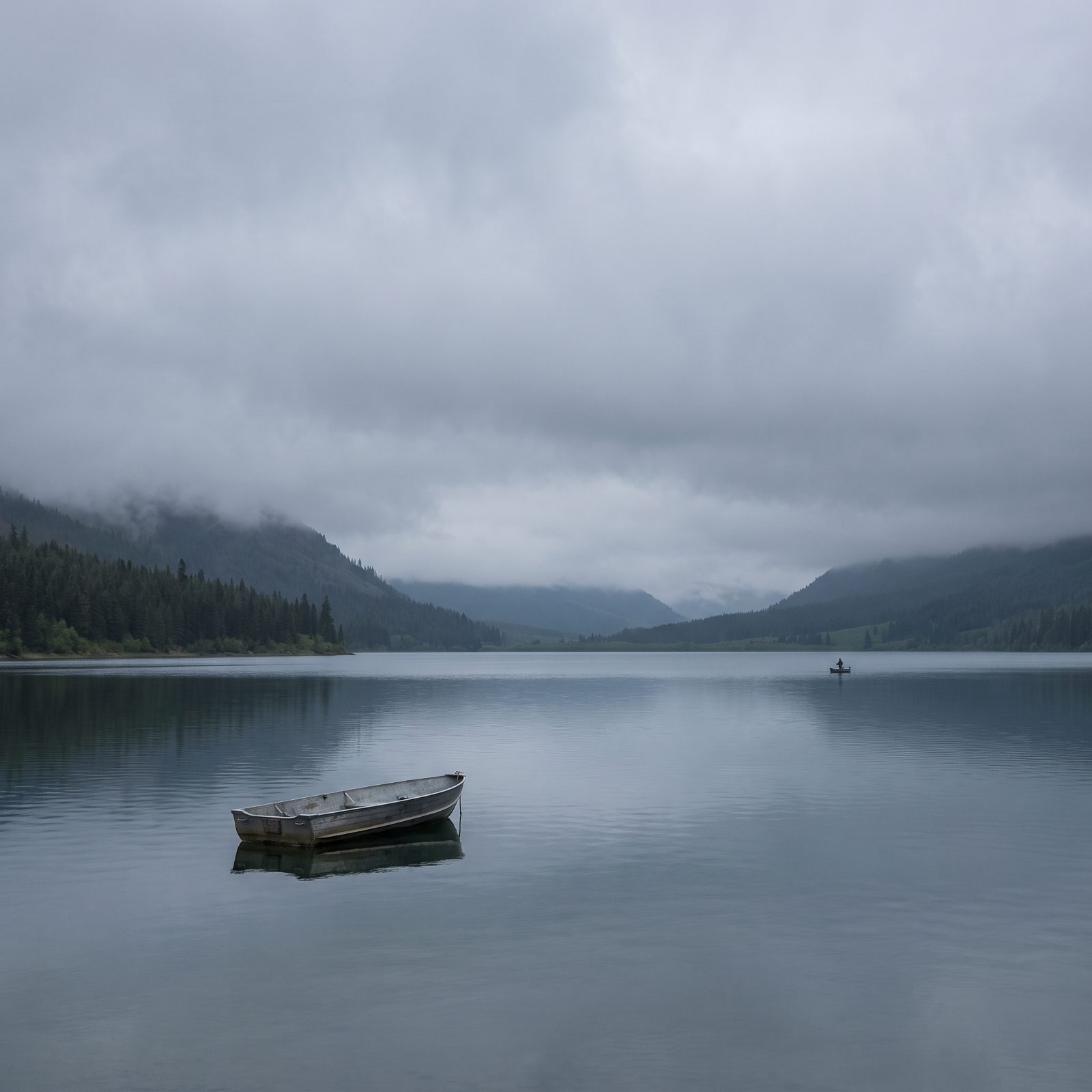
Not all fog burns off. There’s a difference worth learning.
Fog that thins through the morning, growing patchy and letting blue poke through, is on its way out — the sun is winning. But fog that lifts off the ground only to pack itself into a flat, solid gray lid overhead has done something else entirely. It became low stratus.
That deck can sit over you all day. It blocks the sun that would otherwise heat the ground and break things up, so it feeds itself. Counting on a clear afternoon? A thickening gray ceiling by nine or ten in the morning is your cue to adjust the plan.
19. Valley Fog Forming After Sunset Promises a Clear, Calm Night

Fog pooling in the valley after dark is good news if you want a settled night. This kind, called radiation fog, only forms when two things line up: clear skies and light wind.
Here’s the mechanism. With no cloud cover, the ground radiates its heat straight up into space and cools fast after sunset. The air just above cools too, cold air slides downhill into the low spots, and the moisture there condenses into fog. Wind would mix it away. Cloud would trap the heat and stop it forming at all.
So when you spot that white ribbon settling into the bottoms at night, read it backward: the sky above you is clear and the air is calm. A fine night for stars, and usually a cold, still morning behind it.
18. Heavy Morning Dew Tells You the Night Was Clear and Still

Soak your boots crossing the lawn at dawn and the night just handed you a report. Heavy dew means the sky overnight was clear and the wind was light, the same recipe that makes valley fog. Clear skies let the ground cool, cool surfaces pull moisture out of the air, and it beads up on the grass.
Now flip it. A dry morning with no dew at all usually means either cloud cover held the heat in overnight or wind kept the air stirred, and both of those often point to a change moving through. Dry grass at sunrise after a clear forecast is a small flag that something shifted while you slept.
17. Frost Sitting in the Hollows First Marks Cold-Air Drainage Pockets

Frost plays favorites. Walk out on a cold clear morning and you’ll notice it coats the dips, ditches and hollows while the ground just uphill stays green. Not random at all.
Cold air is heavier than warm air, so it drains downhill overnight and pools in the low spots the way water finds a basin. Those pockets, called frost hollows, run several degrees colder than the slopes around them.
Gardeners learn this the hard way when the tomatoes in the low corner die first. For anyone picking a campsite, scouting a late-season hunting spot, or parking the camper overnight, the lesson holds: the bottom of the dip is where the cold collects.
16. Leaves Flashing Their Pale Undersides Mean Gusty Wind Is Coming

The trees go silver before the rain comes. You’ve seen it — a stand of maples or poplars suddenly shimmering pale as a gust rolls through, the whole canopy flashing the undersides of its leaves.
Those undersides are lighter colored, and the leaves are hinged to flip in a stiff wind they’re not used to. A light breeze from the usual direction barely moves them. A gusty shift, often the kind that runs ahead of a storm or a front, cranks them over all at once.
Old farm wisdom read this as rain on the way, and honestly it holds up more often than not. The leaves aren’t predicting anything. They’re just answering the gusty, veering wind that storms shove out in front of themselves.
15. Treetops Thrashing While the Brush Stays Calm Means Stronger Wind Aloft

Stand in a calm forest and look up. If the treetops are bending and streaming while the brush around your knees barely stirs, there’s far more wind up there than down here.
That gap matters. Faster air aloft can mix down to the surface as the day heats up, so a calm morning with thrashing crowns often becomes a windy afternoon on the ground. Canoe paddlers and anyone eyeing a ridgeline hike should take the hint early, before they’re committed and exposed.
Think of the treetops as a free gauge for the layer you can’t feel yet. When they start working harder than the ground-level cover suggests they should, stronger wind is sitting just overhead, waiting for a reason to come down.
14. Snow That Squeaks Loudly Under Your Boots Is Bitterly Cold and Dry

When snow squeaks like styrofoam under every step, it’s calling out the temperature for you. That loud, high squeak only happens in very cold snow, roughly the teens Fahrenheit and below.
Down that cold, the snow crystals are hard and dry and refuse to melt under the brief pressure of your boot. Instead they grind and fracture against each other, and that grinding is the squeak you hear. Near-freezing snow carries a thin film of liquid water on each crystal that lubricates everything, so it packs with a soft crunch and no squeak at all.
13. Big Clumped Snowflakes Falling Mean the Air Is Right Around Freezing

Fat, lazy snowflakes the size of a thumbnail are a thermometer in disguise. Those big flakes are actually clusters — many small crystals that bumped into each other on the way down and stuck together.
Crystals only stick like that when they’re slightly wet, which happens when the temperature through the cloud sits close to freezing, around 32°F. A little warmth puts a tacky film on each crystal, and they clump as they collide.
So the giant flakes mean borderline temperatures, and borderline is the trickiest condition for the ground. That same storm can lay down heavy wet snow that breaks branches, then flip to rain or slush if the air nudges up a degree. Small dry flakes tell you the opposite: it’s cold enough that everything stays powder.
12. Graupel Rattling Down From a Dark Cloud Reveals Unstable, Convective Air
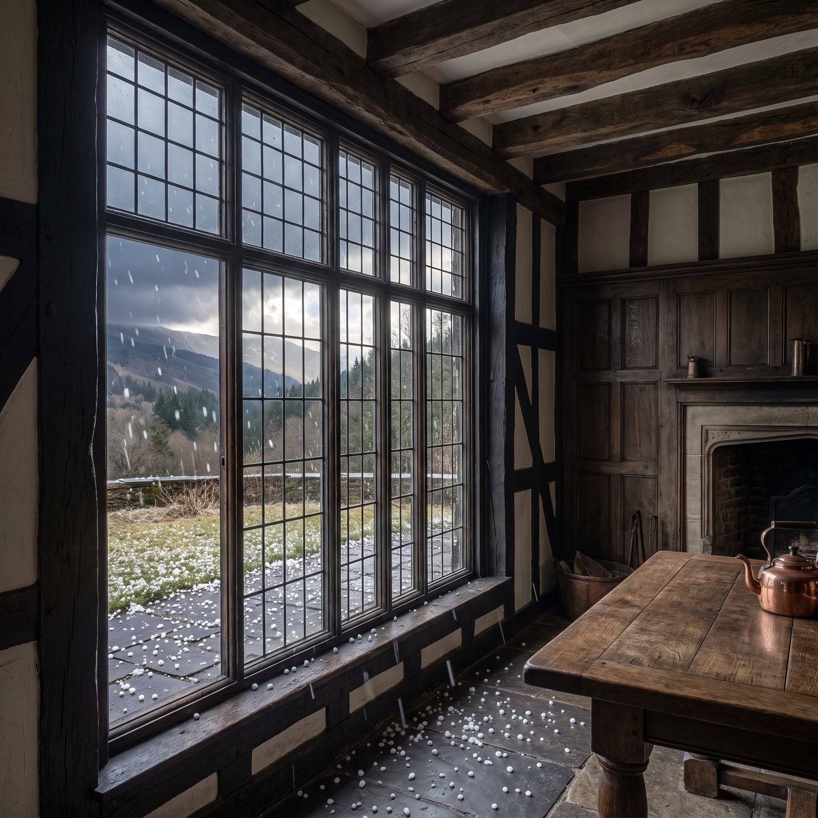
Graupel is the pellet that gives the sky away. Those little white opaque balls, soft enough to crush between your fingers, are snow crystals that fell through a layer of supercooled cloud droplets and got coated in rime ice.
That only happens when air is churning up and down hard inside a tall cloud. The atmosphere, in other words, is unstable and convective — the same engine that drives thunderstorms. Graupel is often the opening act.
When you see it bouncing off your jacket under a dark, towering cloud base, treat it as a warning, not a novelty. Mountain afternoons especially can turn fast. Graupel rattling down is the air telling you it has energy to burn, and if you’re exposed on a ridge or out on open water, that’s the moment to start heading for cover.
11. Low Snakes of Blowing Snow Expose Strong Wind at Ground Level
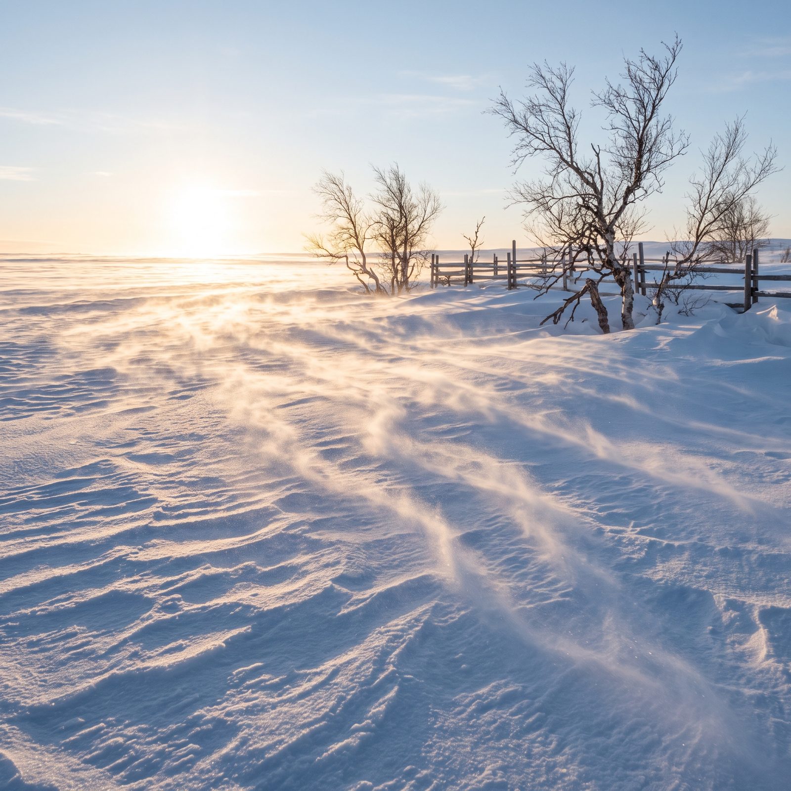
You feel the gusts before you understand them, but the snow tells you first. Those low, writhing ribbons slithering across open ground are blowing snow, and they form when the wind near the surface tops somewhere around 15 to 25 mph. Loose, dry powder lifts; the heavier flakes stay put.
Height is what matters. Snakes that stay ankle-low mean the surface wind is strong but the air above is calmer. When the whole world goes white to eye level, you have ground blizzard conditions, and visibility can vanish in seconds.
10. Dust Devils Reveal Strong Surface Heating and Unstable Low-Level Air
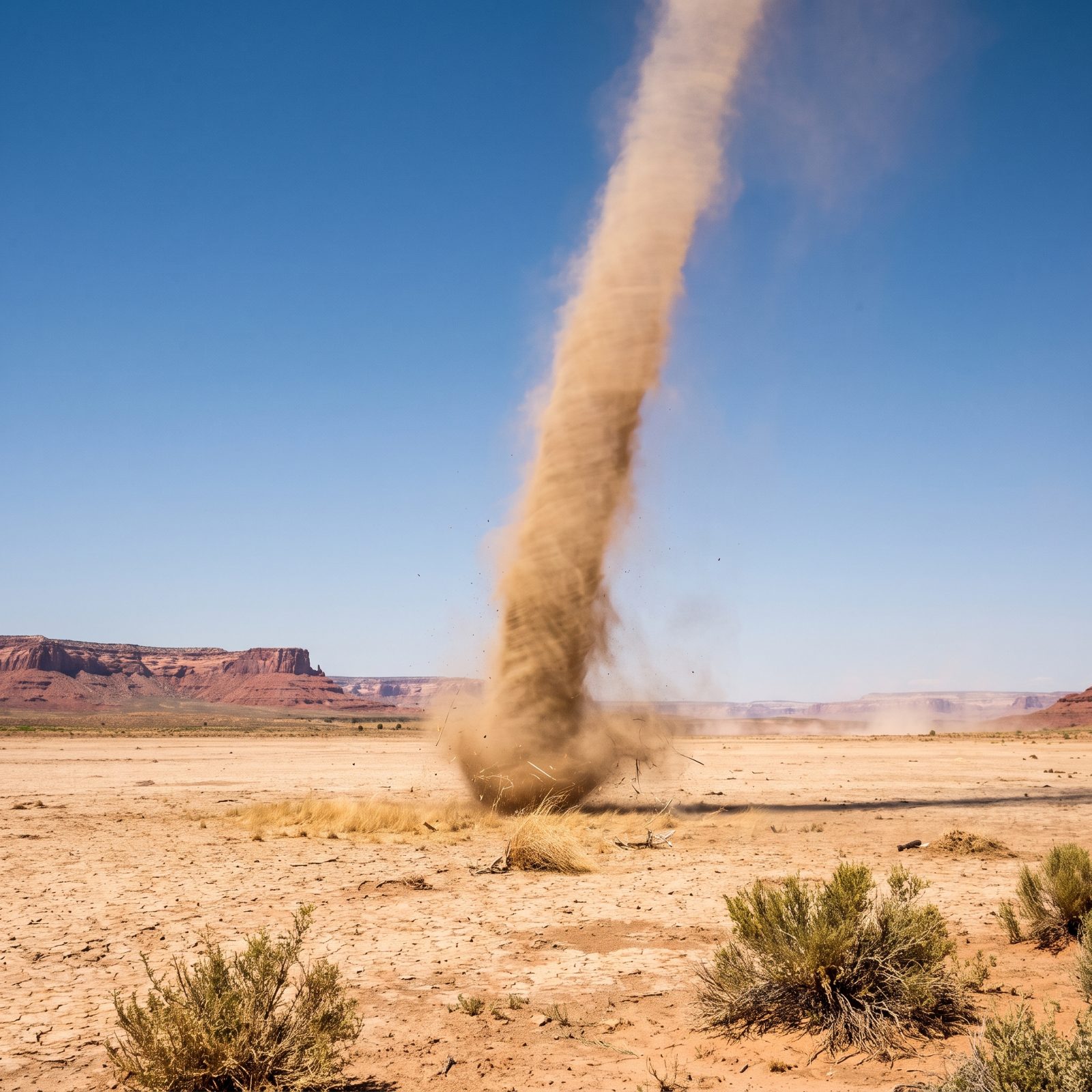
A dust devil is the ground showing you how hard the sun is working. It spins up on clear, calm afternoons: bare soil bakes, superheated air near the surface punches upward through the cooler air above, and a passing eddy sets it turning.
Mostly they’re harmless. A hat chaser, a tent flipper, a reason to weight your rainfly. But read them as a gauge, too. A lot of dust devils tells you the low atmosphere is unstable and itching to rise, and if you add moisture and some afternoon trigger, that same restlessness is exactly what feeds the thunderstorms that show up later.
9. A Halo Around the Sun or Moon Reveals Ice Clouds Advancing Aloft
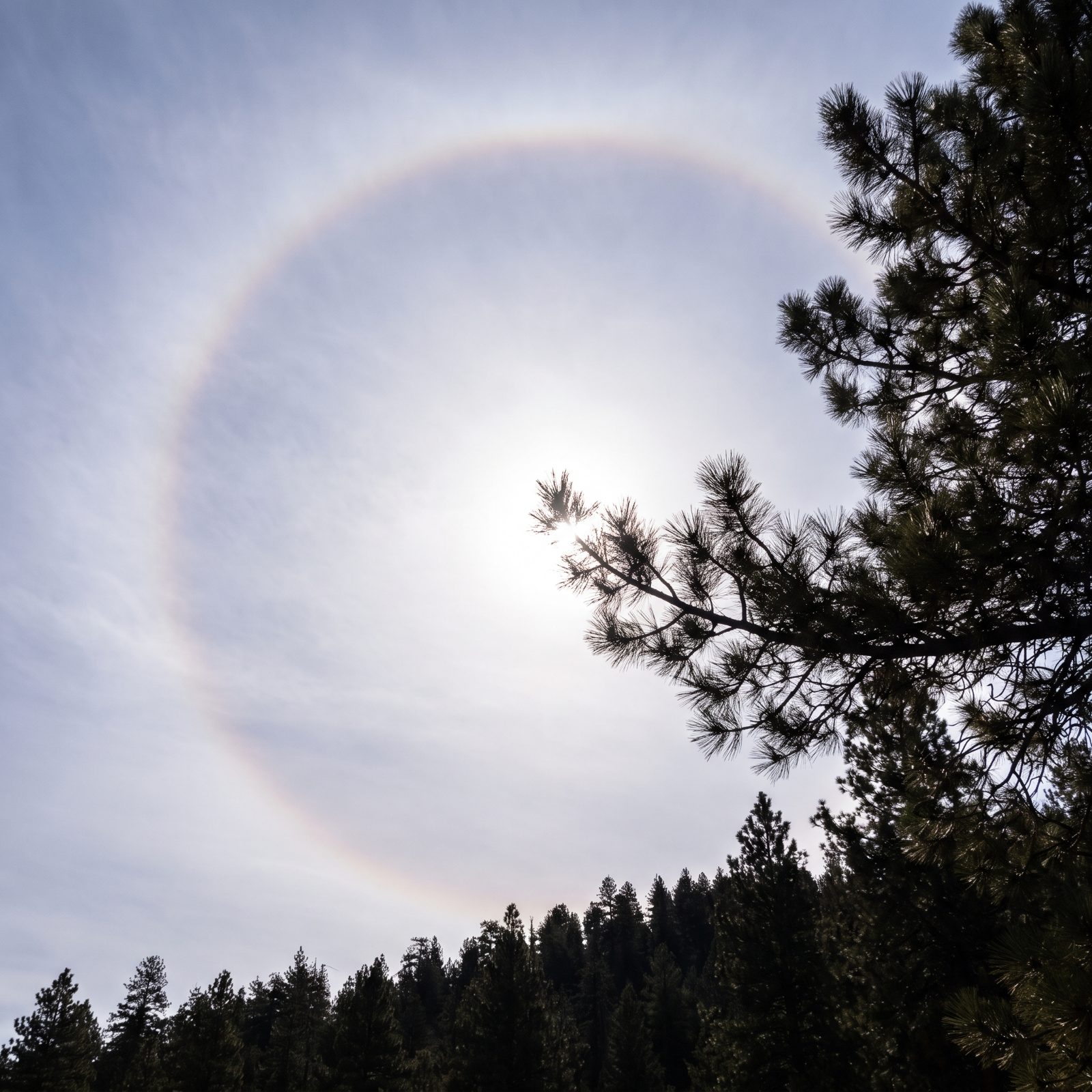
That pale ring circling the sun or moon isn’t luck. It’s light bending through millions of six-sided ice crystals in high cirrostratus cloud, always at the same 22 degrees of separation, which is why the ring never changes size no matter where you stand.
Those ice clouds ride the leading edge of an approaching warm front. The old sailors’ line holds up better than most folk weather: ring around the moon, rain comes soon. Not always, not quick, but a halo one evening followed by thickening, lowering cloud the next day usually means wet weather is a day or so out. Good time to re-pitch the tarp.
8. A Bright Western Horizon Behind Departing Clouds Shows Clearing Air Approaching
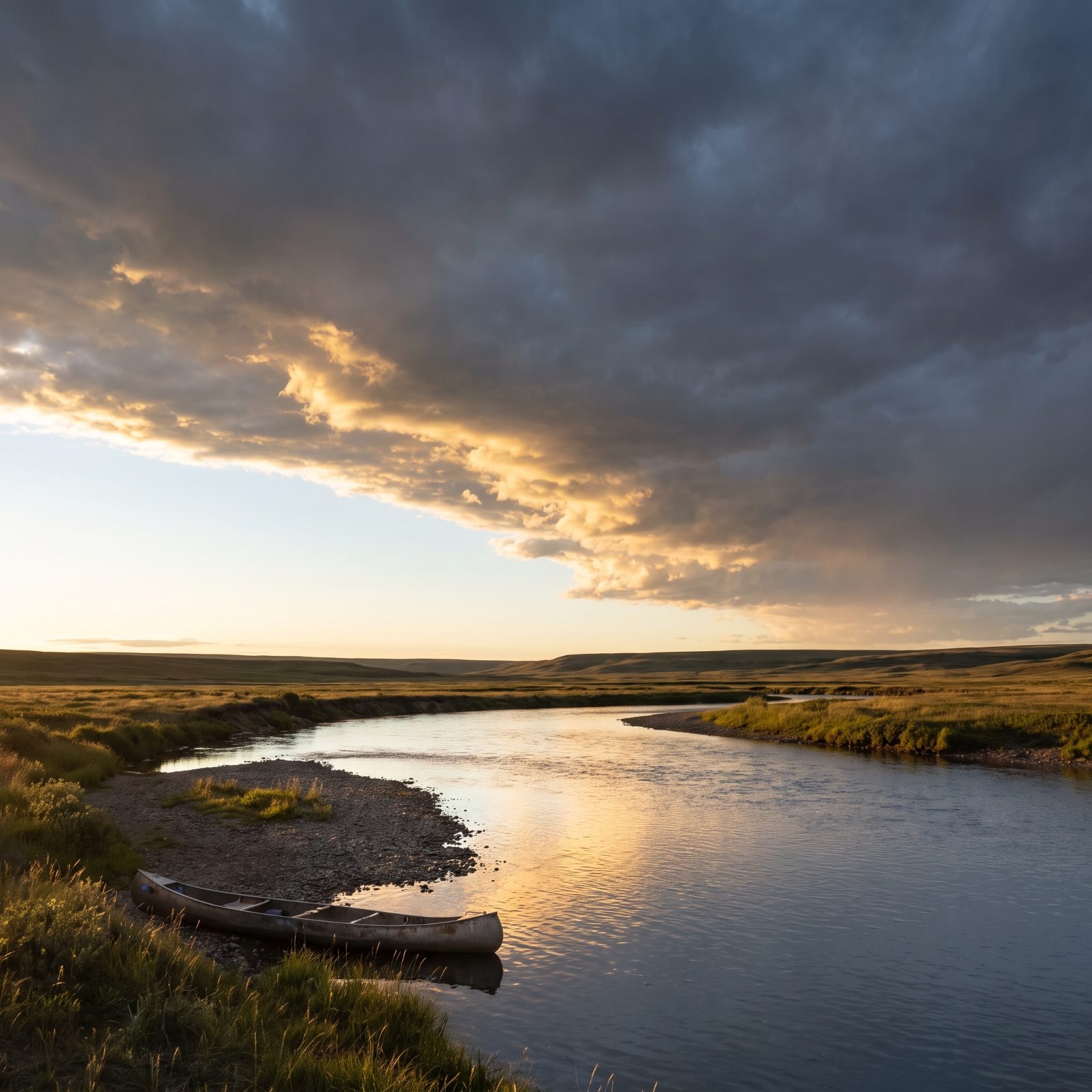
Weather in most of North America travels west to east. So the sky in the west is tomorrow walking toward you. When a storm clears and you want to know whether the break is real, don’t watch the clouds leaving overhead — watch the western horizon behind them.
A bright, clean strip of light low in the west means dry, settling air is riding in on the back of the system. The clearing is genuine. But if the departing clouds give way to a dark, ragged, lowering mass out west? The show isn’t over. Hold the gear. Keep the rain fly up.
7. Petrichor or a Low Shelf Cloud Can Mark a Thunderstorm’s Advancing Outflow
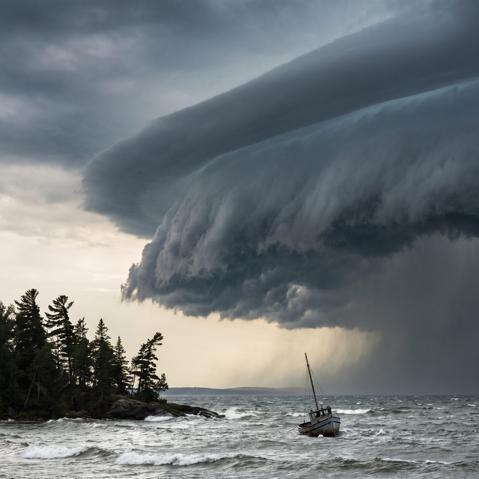
Smell it first. That earthy, mineral scent after a dry spell is petrichor — oils and soil bacteria lofted by the first rain-cooled downdraft arriving ahead of a storm. Your nose often beats your eyes by a good margin.
Then look for the shelf cloud: a long, low, wedge-shaped bar stretching across the leading edge, smooth on top and ragged underneath. It marks the gust front, where cold air pours out of the storm and shoves ahead of it. When a shelf cloud is bearing down and the wind suddenly swings and picks up, the serious weather is minutes away, not an hour. Get off the water and off the ridge.
6. A Greenish Sky Beneath a Storm Can Accompany Heavy Rain and Hail
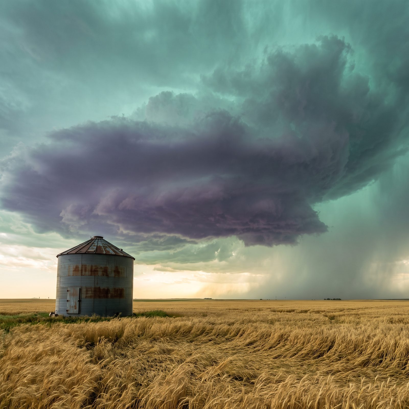
A storm sky that goes green stops conversation, and it should. The color comes from a deep, water-laden storm scattering light, often with hail in the mix, usually when a low sun throws gold through a cloud already full of blue-shifted water. Scientists still argue the exact recipe. The warning isn’t up for debate.
Green doesn’t guarantee a tornado. What it does tell you is that the storm overhead is tall, dense, and loaded with water and ice, so heavy rain, flash flooding, and large hail are all on the table. If the sky above camp turns the color of a bruise, that’s your cue to be under a hard roof.
5. A Rotating Wall Cloud Raises the Risk of a Tornado-Producing Storm
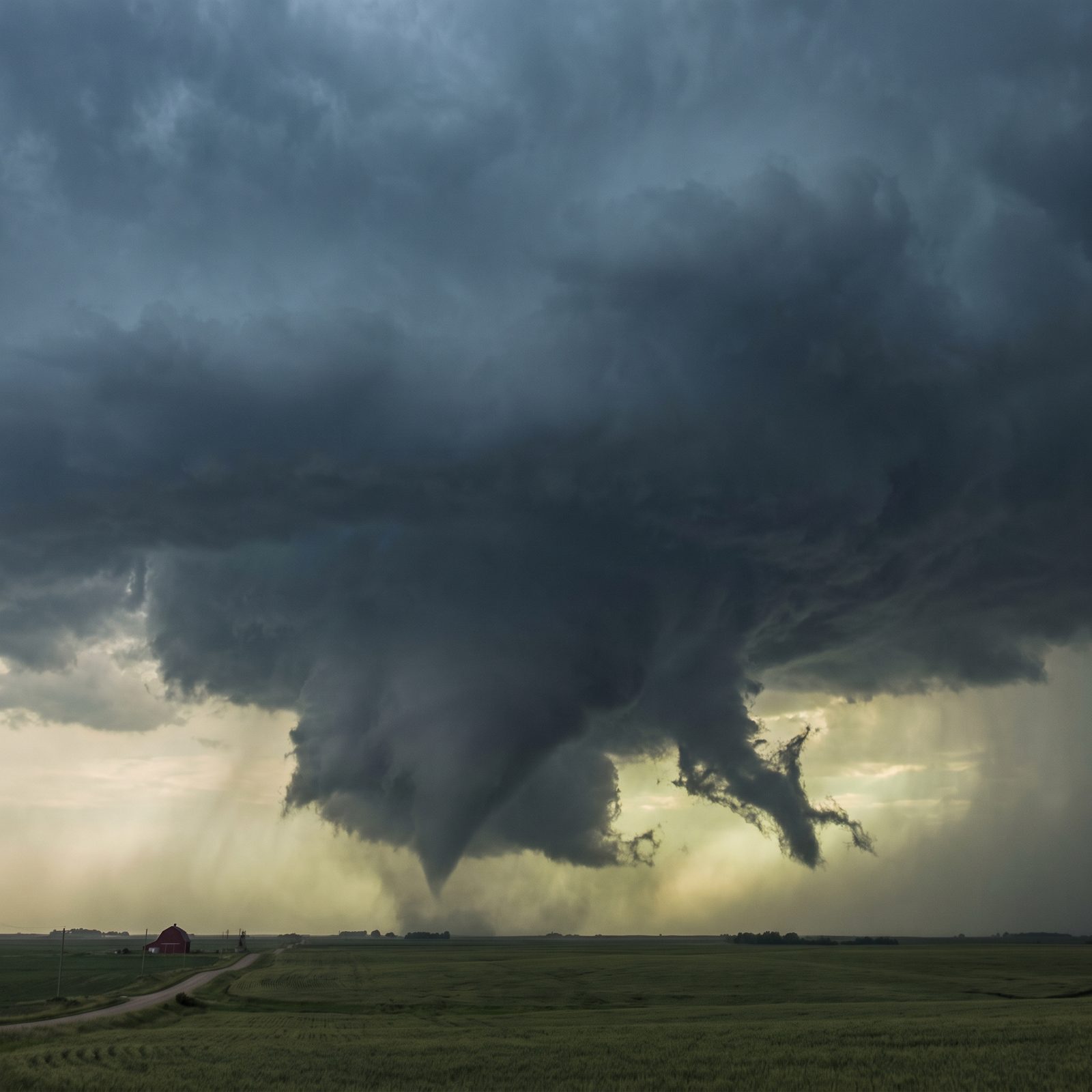
Of everything in the sky, this is the one that matters most.
A wall cloud is an isolated, lowered block of cloud hanging beneath the rain-free base of a thunderstorm, on the trailing side where the rain isn’t. It marks the heart of the updraft. Plenty of wall clouds never do a thing. The dangerous ones rotate.
If you can watch a lowered cloud visibly turning, you are looking at the part of the storm most capable of dropping a tornado.
You’ll often see a ragged tail cloud feeding into it and persistent spinning that just won’t quit. That’s not a photo op. It’s a signal to put a sturdy building or a low ditch between you and it, right now.
4. An Overshooting Anvil Top Identifies an Especially Strong Thunderstorm Updraft

From a safe distance, this is the most telling shape in the sky. A mature thunderstorm flattens out at the top into an anvil when its rising air hits the tropopause and spreads sideways, blocked from climbing any higher. A weak storm stops right there.
A strong one doesn’t. When the updraft has enough muscle to shove a dome of cloud up through and above the flat anvil, that bump is an overshooting top — proof the engine driving the storm is intense, the kind linked to large hail, damaging wind, and severe warnings.
3. Hair Rising or Gear Buzzing Signals an Immediate Lightning Emergency
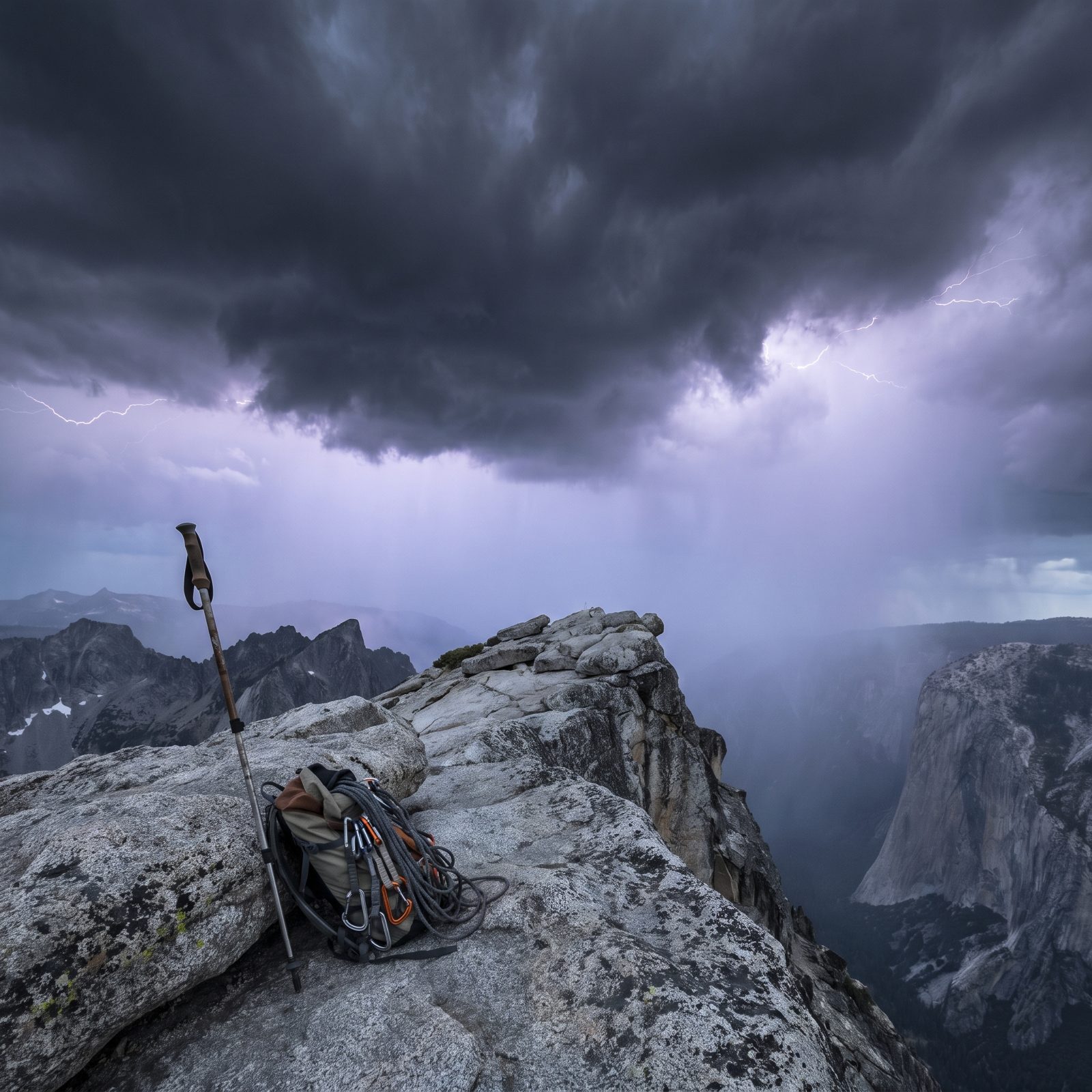
This one isn’t a forecast. It’s the last warning you’ll get.
If your hair stands on end, your skin tingles, metal gear hums or buzzes, or you hear a crackle around the rocks and poles, the electric field around you is building toward a strike. A bolt may be seconds away, and it may be aimed at the high point — which on an exposed ridge is often you.
Drop the metal poles and your frame pack. Get off the summit and away from any lone tree. Crouch low on the balls of your feet, heels together, hands off the ground, making yourself small without lying flat. Then move to safer ground the instant you can. Don’t wait around to confirm it.
2. Shortening Gaps Between Lightning and Thunder Show a Storm Is Getting Closer
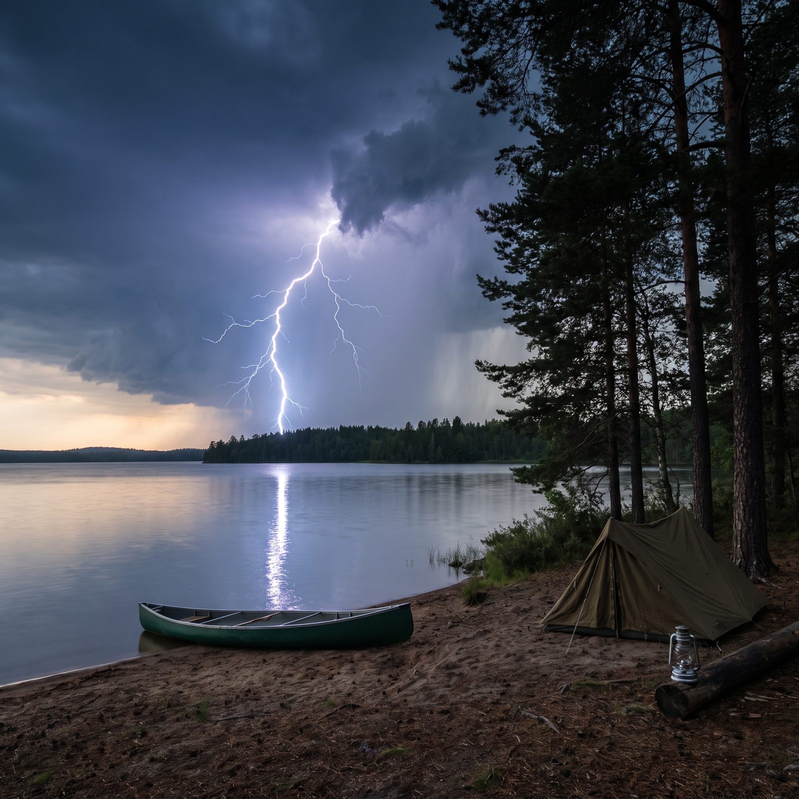
The oldest storm math still works. Light reaches you instantly; sound limps along at roughly one mile every five seconds. Count the seconds from flash to thunder, divide by five, and you’ve got the rough distance in miles.
But the single number means less than the trend. Thirty seconds, then twenty, then ten — the storm is marching toward you, not away. The honest rule most agencies now lean on is dead simple: if you can hear thunder at all, you’re already within strike range. Thirty seconds between flash and bang puts the storm about six miles off, and lightning routinely reaches that far from the parent cloud.
1. Lightning Flashing Faster and Faster Means the Storm Is Winding Up, Not Down
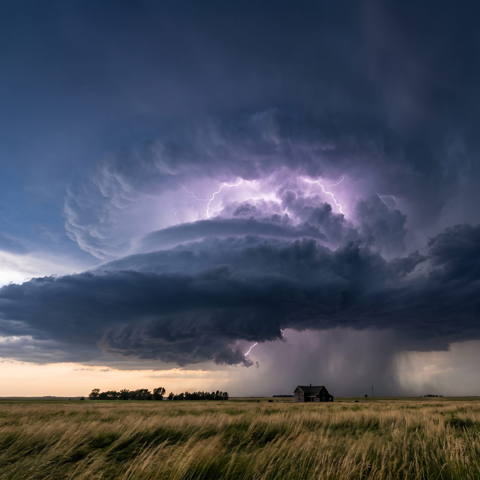
Count the flashes. Not the thunder — the flashes. When lightning that was popping every twenty or thirty seconds suddenly starts stuttering every few seconds, the storm isn’t fading, it’s building. A faster flash rate means the updraft is getting stronger, hauling more ice and charge up into the cloud. Researchers who study severe weather call that sharp run-up a lightning jump, and it tends to show up minutes before the storm throws its worst wind, hail, or a tornado at you.
So if the sky over the ridge starts firing faster while you’re still loading the truck, quit loading. Get inside something solid.
Slowing flashes tell the other half of the story. When the gaps stretch from every ten seconds out toward a full minute, the storm is usually burning through its fuel and sliding past — still close enough to kill you, just no longer gaining strength.