The best mountain view in western North Carolina might be the one you reach in sneakers. Not every ridgeline worth seeing demands switchbacks, trekking poles, or a knee brace by sundown. Some of the finest overlooks in these mountains sit a quarter mile from a parking lot, over paved paths and lakeside loops a stroller can handle. We pulled together walks where the payoff per step is frankly absurd. One thing before you pack the car: Helene did real damage to the Blue Ridge Parkway and parts of the Smokies, so check NPS and Parkway road status before you drive out. Now, the easy ones.
Please note that some of the images in this article were created with the assistance of AI.
12. Price Lake Loop, Julian Price Memorial Park (Blowing Rock)
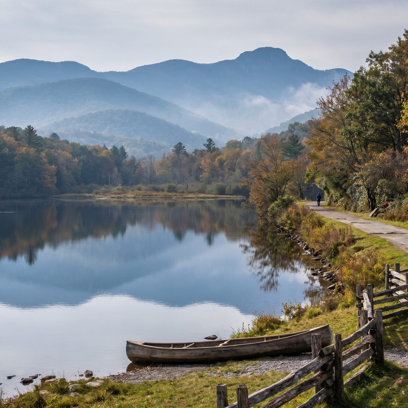
Start at the Price Lake Overlook (Milepost 296.7) where the boats rent in season, or at Boone Fork Overlook (Milepost 297.2). Either way you circle back to your car in about 2.5 miles of nearly level walking, with lake views that carry all the way to Grandfather Mountain.
The first 0.7 mile is paved for wheelchairs and leads to fishing spots and a lakeside deck. Heads up, though. A damaged bridge currently limits that accessible stretch, so don’t count on the full paved section until it’s fixed.
11. Lake Junaluska Walking Trail (Lake Junaluska)
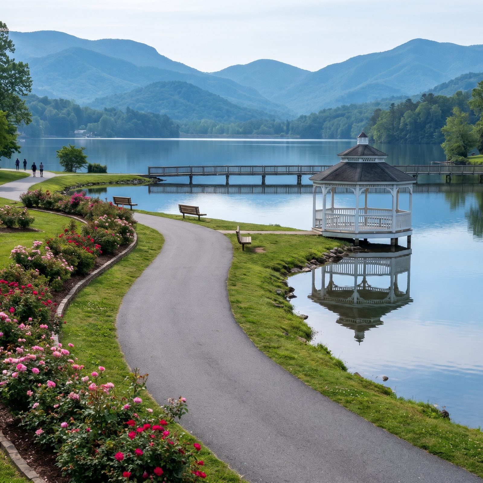
Flat, paved, ringed with mountain views, this one earned Romantic Asheville’s top pick for accessible trails near Asheville. The full loop runs 3.8 miles, but you can trim it to 2.3 by crossing the Turbeville Footbridge and the bridge over the dam.
Wheelchairs, scooters, and strollers all roll fine here. Gazebos and benches dot the route, and the Rose Walk puts out a serious number of roses when they’re blooming. About 25 miles from Asheville, it’s the kind of walk you can do in loafers and still feel like you earned the view.
10. Wiseman’s View, Linville Gorge (Linville Falls)
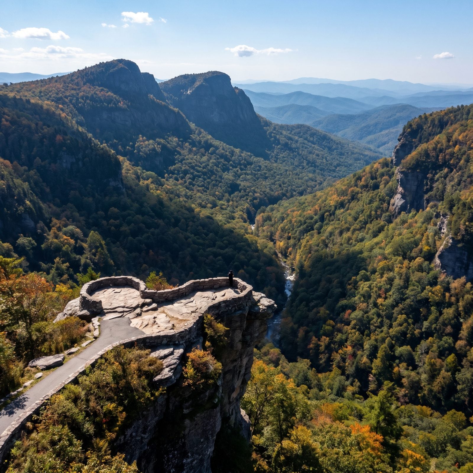
A Forest Service overlook with a paved trail and a single restroom, open all year from 6 a.m. to 10 p.m. The walk is 0.4 mile round trip with maybe 45 feet of climbing, and it dumps you onto twin stone overlooks about 1,500 feet above the Linville River, staring straight across at Hawksbill Mountain and Table Rock.
Here’s the catch nobody mentions. The last four miles of access road are unpaved and pocked with potholes. A higher-clearance vehicle is smart, and a 2026 local report said the road was still rough. Drive it slow and the view is worth every rattle.
9. Mile High Swinging Bridge, Grandfather Mountain (Linville)
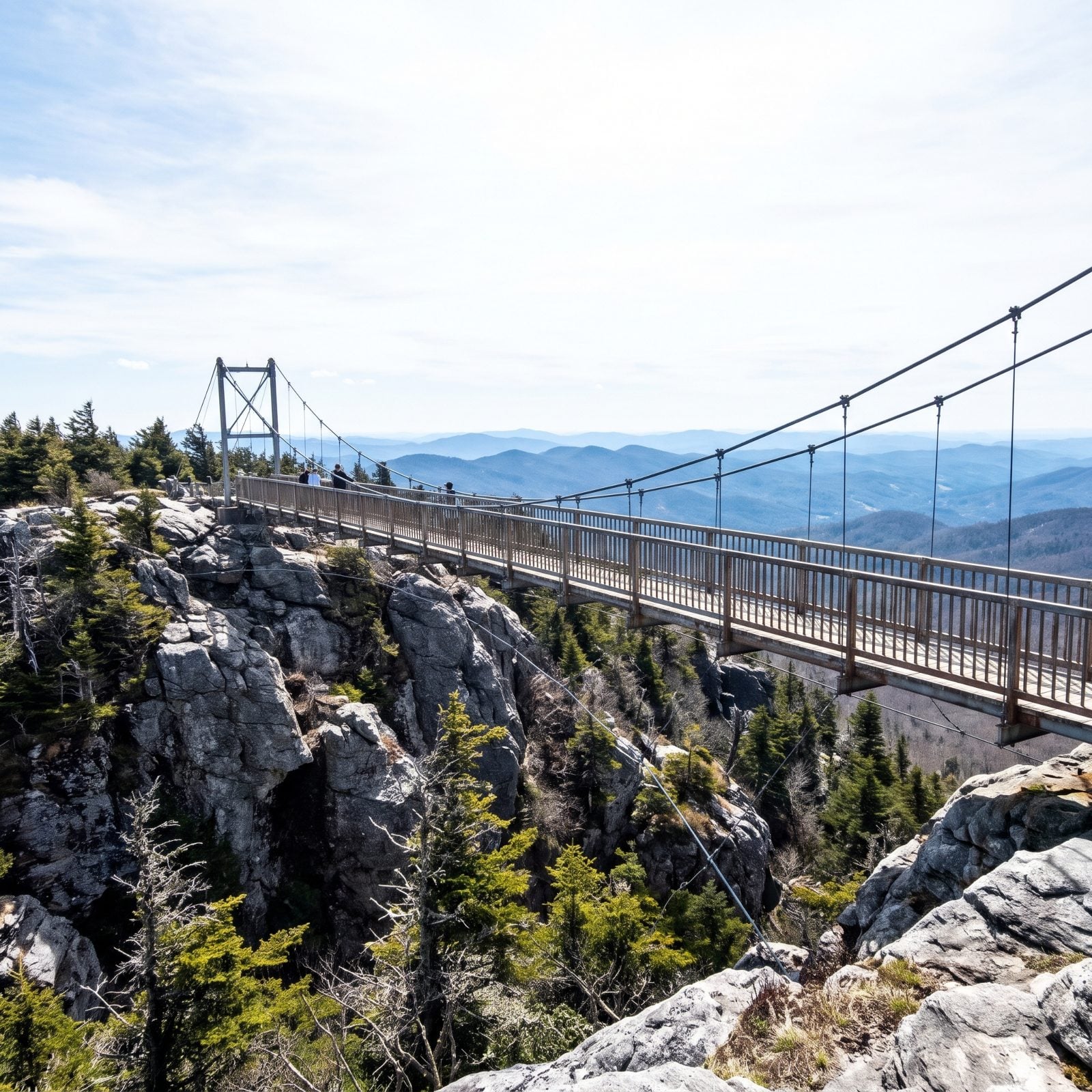
Billed as America’s highest suspension footbridge, this 228-footer crosses an 80-foot chasm near Linville Peak at 5,305 feet, and the views spin a full 360 degrees.
From the summit parking you can climb 50 stairs to reach it, or skip the steps entirely and take the Top Shop elevator to the third floor, which drops you onto a level walk straight out onto the bridge. That elevator is the detail that turns a strenuous summit into an easy one. Crossing is included in Grandfather Mountain admission, and you’ll want to buy tickets online and reserve an entry time, because this place fills up.
8. Mount Mitchell Summit (Burnsville)
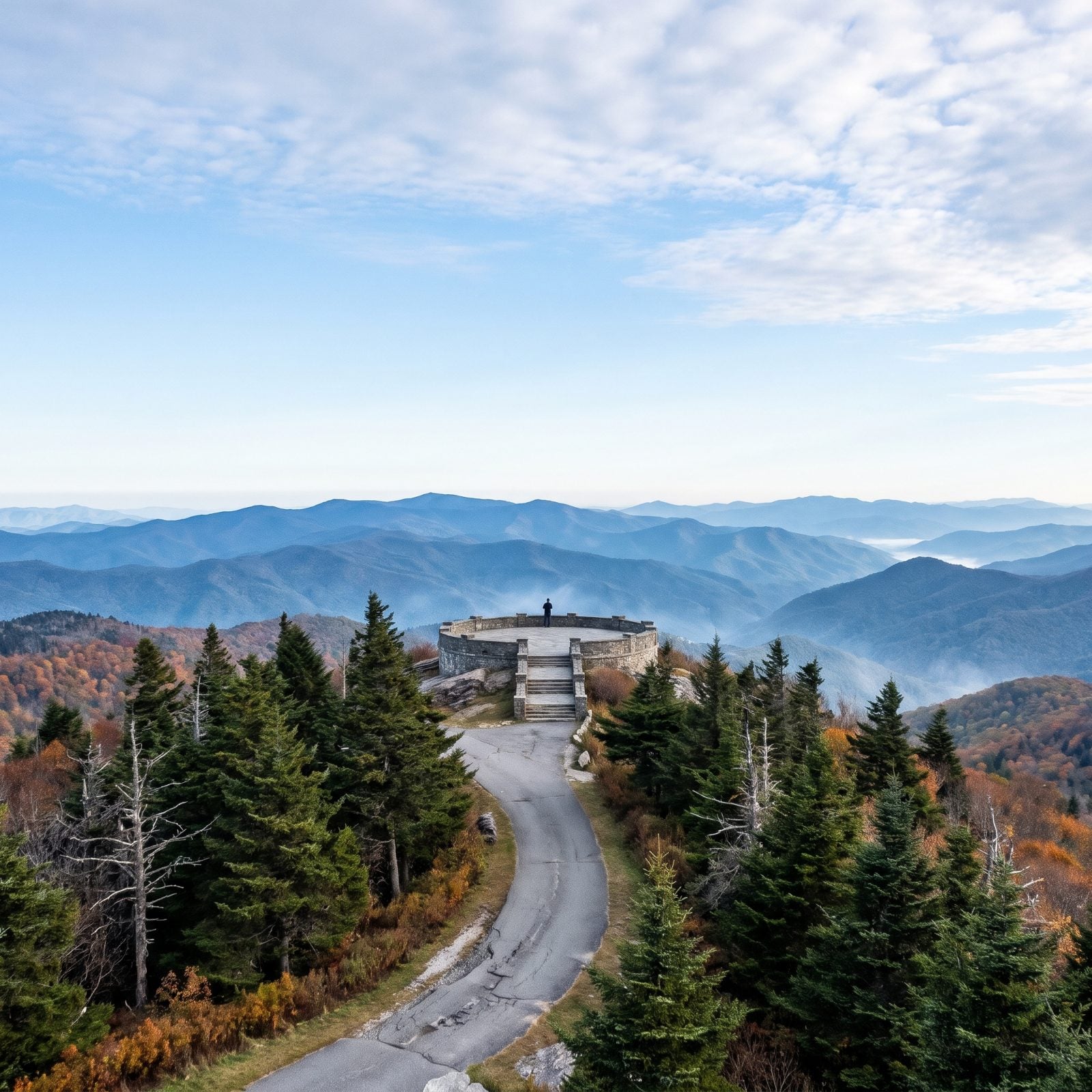
The highest point east of the Mississippi, and the summit path from the parking lot runs only about 0.1 to 0.25 mile to the observation deck at 6,684 feet.
Don’t let the short distance fool you. It’s short but steep in spots, so take your time on the climb. The state park reopened September 15, 2025, when the Parkway reopened from Milepost 382 in Asheville to Milepost 355.3 near the park entrance. The summit concession stand runs 10 a.m. to 5 p.m. daily in season.
7. Flat Rock Trail, Blue Ridge Parkway (Linville)
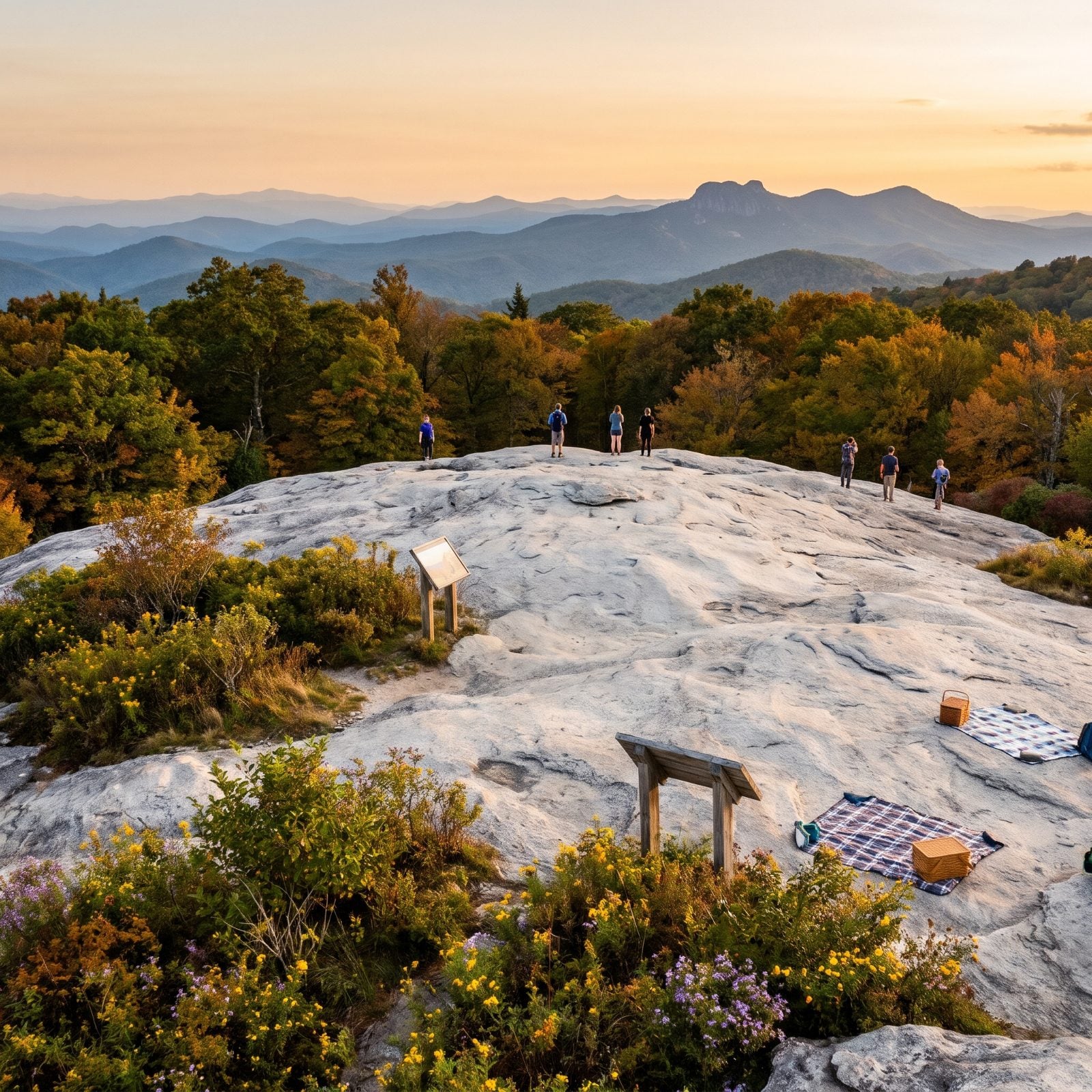
An easy loop of roughly 0.6 to 0.75 mile at Parkway Milepost 308.3, near Linville Falls and Sugar Mountain. It opens onto a smooth rock summit with wide-open views that take in Grandfather Mountain and the Roan Highlands.
The word “flat” refers to the rock dome at the top, not the whole walk, so expect a little rock scrambling underfoot. Interpretive signs explain the forest, and the open stone makes a fine picnic perch. Want another short summit nearby? Beacon Heights at Milepost 305 is a similar quick walk about three miles north.
6. Little Pinnacle Overlook, Pilot Mountain State Park (Pinnacle)
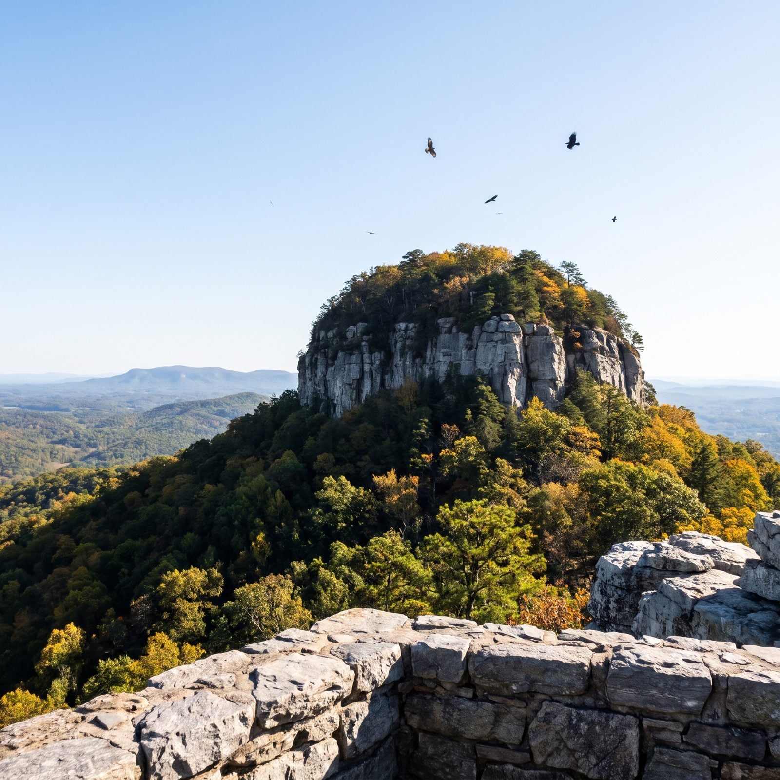
The easiest walk to a famous view on this whole list. From the upper summit parking area, it’s 0.1 mile one way to Little Pinnacle Overlook and its postcard look at Big Pinnacle, with Hanging Rock State Park off in the distance.
Want a little more? Just past the overlook, the Pilot Knob Trail (once called the Jomeokee Trail) drops down stone steps for a 0.8-mile loop around the base of Big Pinnacle, where hawks and ravens ride the thermals. Park address is 1792 Pilot Knob Park Road. And one note for the mountain purists: this is a Piedmont monadnock, not part of the Blue Ridge. The view doesn’t care about geology.
5. Oconaluftee River Trail (Cherokee)
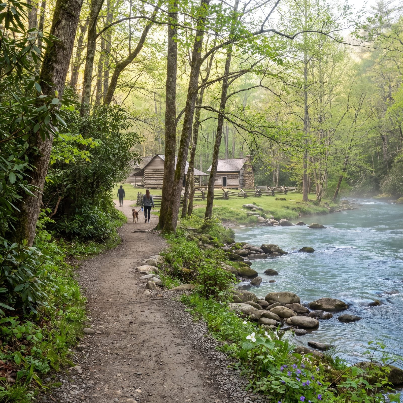
One of only two trails in the entire Smokies where dogs and bikes are welcome, which alone makes it worth knowing. The path runs 1.5 to 1.6 miles one way from the Oconaluftee Visitor Center and Mountain Farm Museum to the outskirts of Cherokee, mostly flat with a few small rises.
Thousands walk it every year, and for good reason. Historic farm buildings on one end, a river at your side the whole way. No entrance fee, but you’ll need a paid parking tag to stay longer than 15 minutes.
4. Fontana Dam (Fontana Dam)
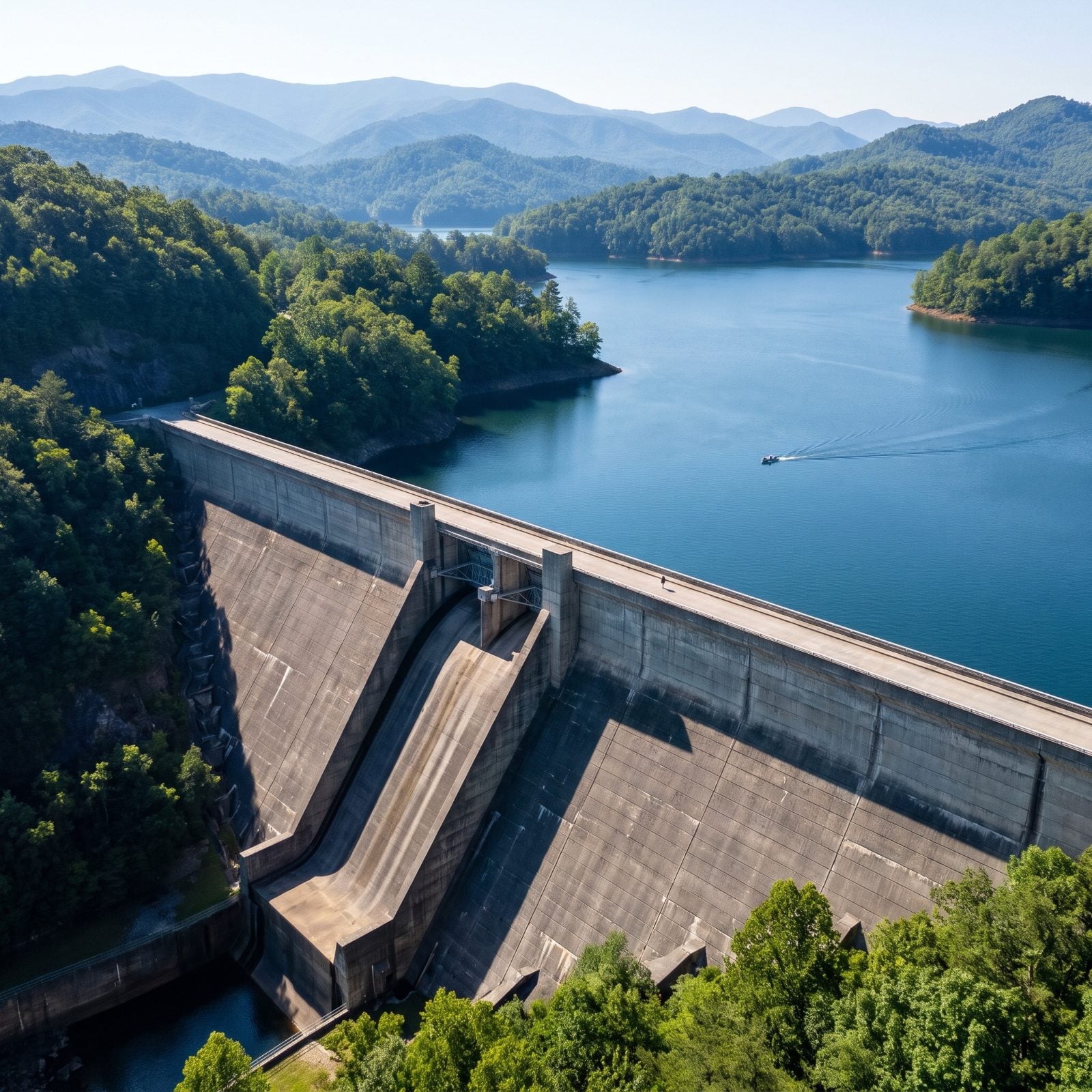
You can walk or drive straight across the top of the tallest dam east of the Rockies, all 480 feet of it, and look out over Fontana Lake, the largest lake in western North Carolina.
The Appalachian Trail crosses here, so you might share the dam with a thru-hiker smelling like three weeks in the woods. A TVA visitor center tells the story of the 1940s construction. The national park and Nantahala National Forest protect about 90 percent of the lake’s 238-mile shoreline, which is why the water looks so wild for something made of concrete.
3. Bass Lake Loop, Moses H. Cone Memorial Park (Blowing Rock)
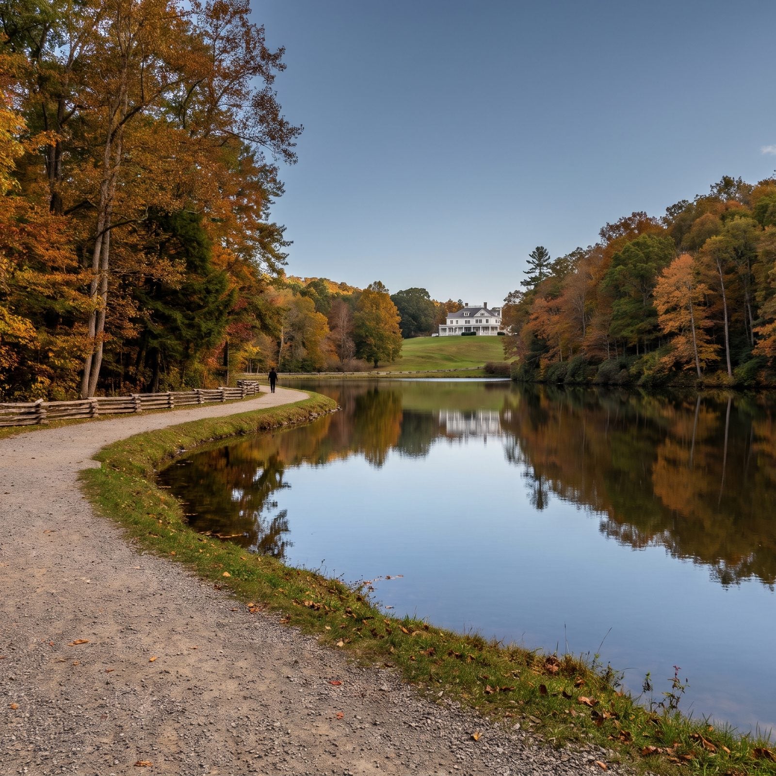
If you want the gentlest walk here, this is it. A flat, wide loop of about a mile around Bass Lake with barely any climb, roughly 16 feet over the whole thing.
No entrance fee, no permit, with restrooms at both Cone Manor and the lake. The old eroding gravel ramp from the parking lot down to the trail has been replaced by a new concrete, ADA-accessible path built by the Blue Ridge Parkway Foundation in 2025, so more people can reach the water. Easy walk, easy view, easy day.
2. The Lagoon Shore at Biltmore Estate, Asheville
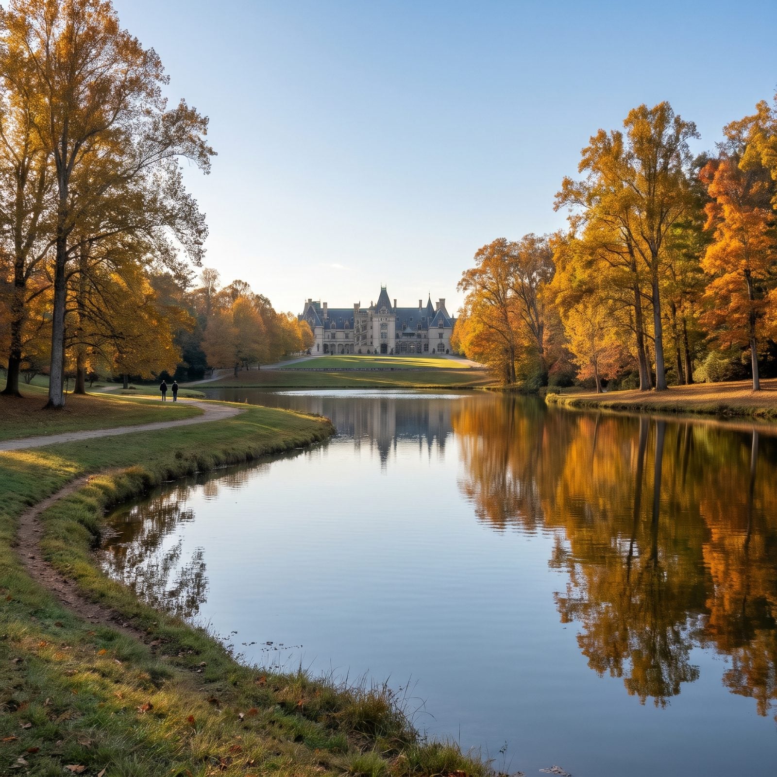
You pay to get in. But once you’re past the gate, the easiest view on the whole property costs nothing but a short stroll. The Lagoon sits below Biltmore House, and from its grassy shore you look back up at the limestone facade reflected in still water — flat ground, benches, room to spread a picnic.
Don’t stop there, though. The South Terrace Tea House opens onto Mount Pisgah and the south end of the house, and the hill by the Statue of Diana frames the mansion with the Blue Ridge piled up behind it. Three different postcards, barely any climbing between them.
1. Cataloochee Valley, Great Smoky Mountains near Waynesville
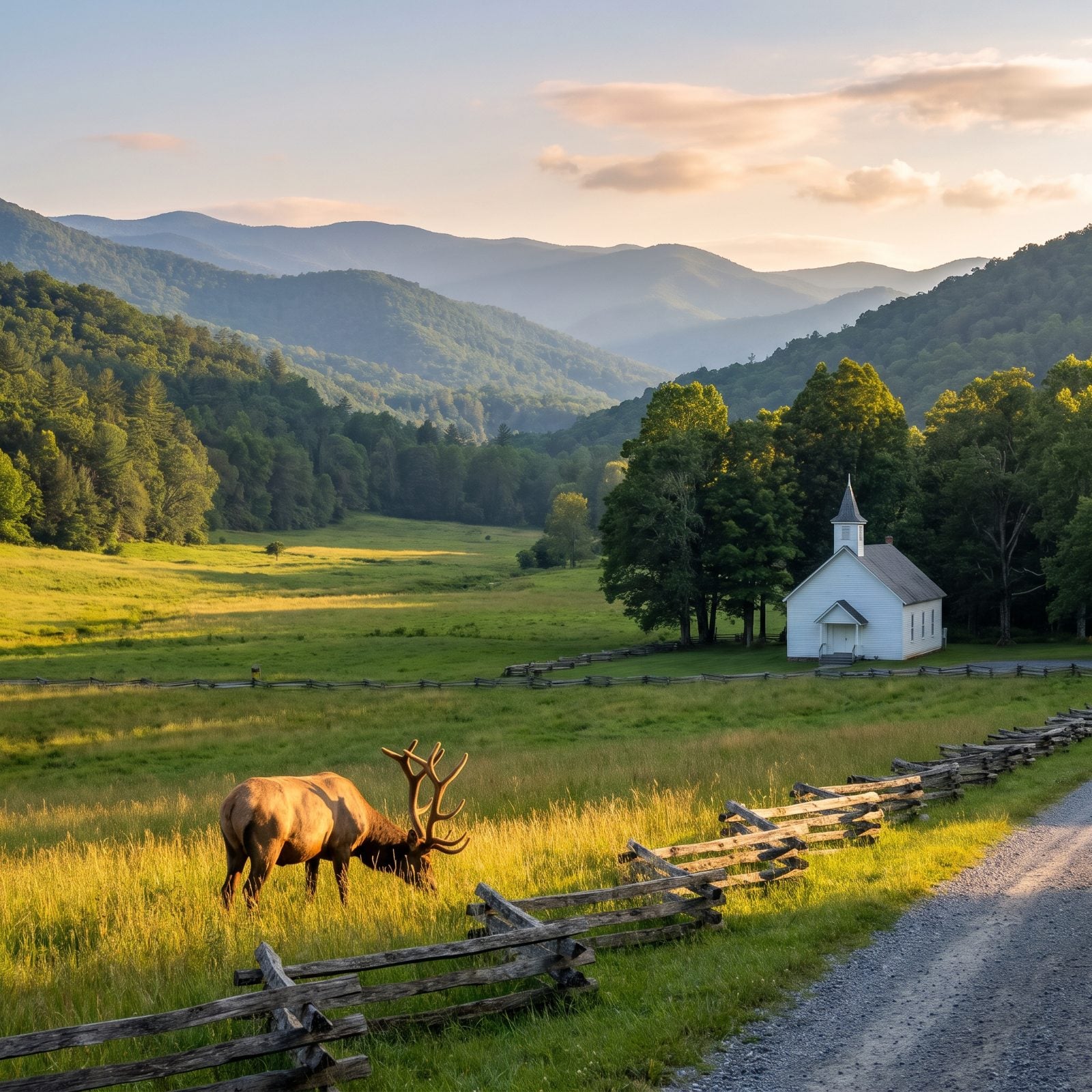
This is the valley where the elk came back. Nine historic buildings still stand scattered through the fields — Palmer Chapel, an old school, a barn among them — with ridgelines closing in on every side. The walking stays gentle; the Rough Fork Trail runs gentle and short from the end of the valley road (since Helene, cars have been stopped near Beech Grove School, so expect an extra walk down the closed road to reach it), following a stream over log footbridges to the Woody House.
Come in the last hour of light, or right at dawn, if you want elk. That’s when they move. And keep your distance. The park’s rule is 50 yards, and through September and October the fields close entirely to give the animals room during the rut, so watch from the roadside instead.
One honest warning before you load the truck. The road in is remote and winding, and parts of the Smokies and the Parkway took a beating from Helene. Driving all the way out to find a trailhead chained shut is a long, slow way to learn that lesson. Check NPS road status before you point the wheels toward Cataloochee.